
Deutsch-Chinesische Enzyklopädie, 德汉百科
 Eurovision Song Contest,ESC
 UEFA European Championship 2020

 International cities
 *European Capital of Culture
 Netherlands
 Olympic Summer Games
 1928 Summer Olympics

 World Heritage

 Important port
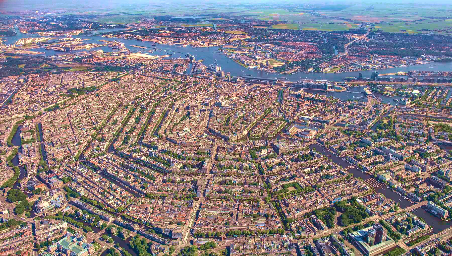
阿姆斯特丹(荷兰语:Amsterdam[ɑmstərˈdɑm] ),是荷兰首都及最大城市,位于该国西部省份北荷兰省。根据2008年1月的统计数据,这座城市人口达747,290人;而该城市所处的兰斯台德都市圈,大约有670万人口,是欧洲第6大都市圈。
其名称源于Amstel dam,这表明了该城市的起源:一个位于阿姆斯特尔河上的水坝,即今水坝广场址。12世纪晚期一个小渔村建于此,而后由于贸易的迅猛发展,阿姆斯特丹在荷兰黄金时代一跃而成为世界上最重要的港口。在那个时代,该城是金融和钻石的中心。 19和20世纪,该城扩展,许多新的街坊与近郊住宅区形成。
阿姆斯特丹是荷兰的金融和文化首都。许多荷兰大型机构的总部都设于此,其中包括飞利浦和ING等7家世界500强企业的总部。作为泛欧交易所的一部分,阿姆斯特丹证券交易所坐落于城市中心。阿姆斯特丹有很多旅游景点,包括历史悠久的运河网、荷兰国家博物馆、凡·高博物馆、安妮之家、红灯区以及许多大麻咖啡馆。每年有大约420万游客来此观光。
作为当前荷兰第一大城市,阿姆斯特丹历经了从渔村到国际化大都市的发展过程,经历了辉煌与破坏,以及世界大战的洗礼,从一定程度上讲,她的历史也是荷兰历史的一个缩影。
Amsterdam (niederländisch ) ist die Hauptstadt und einwohnerstärkste Stadt des Königreichs der Niederlande. Die Gemeinde Amsterdam hat 851.223 Einwohner (Stand: 31. August 2017)[2] und als Agglomeration Groot-Amsterdam 1.362.270 Millionen (Stand: 28. Februar 2018).[3] Im Großraum Amsterdam, der den nördlichen Teil des niederländischen Verdichtungsraumes Randstad ausmacht, leben etwa 2,4 Millionen Menschen (2012).[4] Auch wenn sich der Regierungssitz des Landes sowie die Königsresidenz im 60 Kilometer entfernten Den Haag befinden, ist Amsterdam seit 1983 gemäß niederländischer Verfassung die Hauptstadt der Niederlande.[5]
Amsterdam liegt in der niederländischen Provinz Nordholland, wo Amstel und IJ direkt hintereinander in das IJsselmeer münden. Der Hafen der Stadt ist durch den Nordseekanal mit der Nordsee verbunden. Amsterdam ist für die vielen Grachten weltberühmt.
アムステルダム(オランダ語: Amsterdam [ˌʔɑmstərˈdɑm] (![]() 音声ファイル))は、オランダの北ホラント州の基礎自治体(ヘメーンテ)であり、オランダ最大の都市である。人口820,654人(2012年)、都市圏人口は2,289,762人にのぼる。商業や観光が盛んなヨーロッパ屈指の世界都市である[6]。オランダ語での発音は片仮名で表記すると「アムスタダム」に近い。地名は「アムステル川のダム(堤防)」の意(「ダム広場」の項を参照)。
音声ファイル))は、オランダの北ホラント州の基礎自治体(ヘメーンテ)であり、オランダ最大の都市である。人口820,654人(2012年)、都市圏人口は2,289,762人にのぼる。商業や観光が盛んなヨーロッパ屈指の世界都市である[6]。オランダ語での発音は片仮名で表記すると「アムスタダム」に近い。地名は「アムステル川のダム(堤防)」の意(「ダム広場」の項を参照)。
憲法に規定されたオランダの首都だが、国会、中央官庁、王宮、各国の大使館など首都機能のほとんどはデン・ハーグにある[7]。
元々は小さな漁村だったが、13世紀にアムステル川の河口にダムを築き、町が築かれた。16世紀には海運貿易の港町として、ヨーロッパ屈指の都市へと発展した。現在のアムステルダムは、アムステルダム中央駅を中心に市内に網の目状に広がる運河や、その運河に沿って並ぶ無総督時代の豪商の邸宅、自転車、飾り窓の女性たち、アンネ・フランクの家などで広く知られる。
Amsterdam (/ˈæmstərdæm/, UK also /ˌæmstərˈdæm/;[9][10] Dutch: [ɑmstərˈdɑm] (![]() listen)) is the capital and most populous municipality of the Netherlands. Its status as the capital is mandated by the Constitution of the Netherlands,[11] although it is not the seat of the government, which is The Hague.[12] Amsterdam has a population of 851,373 within the city proper, 1,351,587 in the urban area,[13] and 2,410,960 in the Amsterdam metropolitan area.[8] The city is located in the province of North Holland in the west of the country but is not its capital, which is Haarlem. The metropolitan area comprises much of the northern part of the Randstad, one of the larger conurbations in Europe, with a population of approximately 8 million.[14]
listen)) is the capital and most populous municipality of the Netherlands. Its status as the capital is mandated by the Constitution of the Netherlands,[11] although it is not the seat of the government, which is The Hague.[12] Amsterdam has a population of 851,373 within the city proper, 1,351,587 in the urban area,[13] and 2,410,960 in the Amsterdam metropolitan area.[8] The city is located in the province of North Holland in the west of the country but is not its capital, which is Haarlem. The metropolitan area comprises much of the northern part of the Randstad, one of the larger conurbations in Europe, with a population of approximately 8 million.[14]
Amsterdam's name derives from Amstelredamme,[15] indicative of the city's origin around a dam in the river Amstel. Originating as a small fishing village in the late 12th century, Amsterdam became one of the most important ports in the world during the Dutch Golden Age (17th century), a result of its innovative developments in trade. During that time, the city was the leading centre for finance and diamonds.[16] In the 19th and 20th centuries the city expanded, and many new neighbourhoods and suburbs were planned and built. The 17th-century canals of Amsterdam and the 19–20th century Defence Line of Amsterdam are on the UNESCO World Heritage List. Since the annexation of the municipality of Sloten in 1921 by the municipality of Amsterdam, the oldest historic part of the city lies in Sloten (9th century).
As the commercial capital of the Netherlands and one of the top financial centres in Europe, Amsterdam is considered an alpha world city by the Globalization and World Cities (GaWC) study group. The city is also the cultural capital of the Netherlands.[17] Many large Dutch institutions have their headquarters there, and seven of the world's 500 largest companies, including Philips, AkzoNobel, TomTom and ING, are based in the city.[18] Also, many leading technology companies have their European headquarters in Amsterdam, such as Uber, Netflix and Tesla.[19] In 2012, Amsterdam was ranked the second best city to live in by the Economist Intelligence Unit (EIU)[20] and 12th globally on quality of living for environment and infrastructure by Mercer.[21] The city was ranked 3rd in innovation by Australian innovation agency 2thinknow in their Innovation Cities Index 2009.[22] The Port of Amsterdam to this day remains the second in the country, and the fifth largest seaport in Europe.[23] Famous Amsterdam residents include the diarist Anne Frank, artists Rembrandt van Rijn and Vincent van Gogh, and philosopher Baruch Spinoza.
The Amsterdam Stock Exchange, the oldest stock exchange in the world, is located in the city centre. Amsterdam's main attractions, include its historic canals, the Rijksmuseum, the Van Gogh Museum, the Stedelijk Museum, Hermitage Amsterdam, the Anne Frank House, the Scheepvaartmuseum, the Amsterdam Museum, the Heineken Experience, the Royal Palace of Amsterdam, Natura Artis Magistra, Hortus Botanicus Amsterdam, NEMO Science Museum, its red-light district and its many cannabis coffee shops draw more than 5 million international visitors annually.[24] The city is also well known for its nightlife and festival activity; several of its nightclubs (Melkweg, Paradiso) are among the world's most famous. It is also one of the world's most multicultural cities, with at least 177 nationalities represented.[25]
Amsterdam (Écouter) est la commune la plus peuplée et la capitale du royaume des Pays-Bas, bien que le gouvernement ainsi que la plupart des institutions du pays siègent à La Haye. Sur la base des chiffres de l'année 2017, la commune d'Amsterdam compte plus de 850 000 habitants appelés Amstellodamois, au cœur de la région d'Amsterdam qui regroupe environ 1 350 000 habitants. L'aire urbaine, qui rassemble plus de 2 400 000 résidents3,4 fait elle-même partie d'une conurbation appelée Randstad Holland qui compte 7 100 000 habitants. La ville est située en Hollande-Septentrionale, mais n'est cependant pas la capitale de la province, cette dernière étant Haarlem, située à 19 kilomètres à l'ouest d'Amsterdam.
Le nom de la commune vient de l'ancien nom néerlandais Amstelredamme évoquant les origines de la ville : la digue (Dam) sur l'Amstel. Petit village de pêcheurs au XIIe siècle, la ville connaît une très forte croissance au Moyen Âge au point de devenir l'un des principaux ports du monde durant le Siècle d'or néerlandais. Le quartier De Wallen est la partie la plus ancienne de la ville, qui se développe autour d'un réseau concentrique de canaux semi-circulaires reliés par des canaux perpendiculaires, formant une « toile d'araignée ». Au centre de la vieille ville se trouve, sur la place du Dam, le palais royal d'Amsterdam, construit au XVIIe siècle, symbole de l'importance de la ville. Guillaume Ier en fait sa résidence en 1815. Depuis juillet 2010, le quartier du Grachtengordel, délimité par le Herengracht, Keizersgracht et Prinsengracht, figure sur la liste du patrimoine mondial de l'UNESCO. Dans cette zone que se trouve le renommé béguinage d'Amsterdam, cour arborée et bordée d'habitations anciennes — la plus vieille datant de 1528 environ — abritant en son sein une chapelle anglicane.
Amsterdam est l'un des centres économiques majeurs des Pays-Bas et l'un des principaux centres financiers d'Europe. Les sièges sociaux de plusieurs firmes multinationales (Philips, AkzoNobel, ING et TomTom notamment) sont situés dans la ville et d'autres ont leurs bureaux européens basés à Amsterdam (principalement Netflix, Uber et Tesla). La ville est également la première destination touristique et culturelle néerlandaise, notamment du fait de la renommée ses principaux musées concentrés autour du Museumplein : le musée d'État, la fondation d'art moderne Stedelijk Museum et le Van Gogh Museum figurent parmi les plus visités au monde. D'autres lieux culturels d'importance sont le musée scientifique NEMO, l'Institut royal des Tropiques, le musée d'art Hermitage, l'institut du cinéma EYE, le musée maritime néerlandais et la Maison Anne Frank.
Divers classements placent Amsterdam parmi les métropoles mondiales offrant le meilleur confort de vie5, le magazine américain Forbes la positionnant à la première place en 20166. Selon l'Economist Intelligence Unit, elle est également la deuxième ville la plus sûre d'Europe après Stockholm7. La majorité des déplacements en ville s'effectue grâce aux quinze lignes de tramway, aux cinq lignes de métro, à pied ou à vélo. La ville est réputée pour ses événements festivaliers (particulièrement l'Amsterdam Music Festival, Sensation, In Qontrol et Uitmarkt), ses discothèques (spécifiquement Paradiso et Melkweg) et ses salles de concert (notamment le Ziggo Dome, Concertgebouw, Heineken Music Hall et Stadsschouwburg). Amsterdam est aussi connue pour son quartier rouge, ainsi que pour ses nombreux coffee shops possédant une licence leur permettant de commercialiser le cannabis, reflétant le progressisme politique des Pays-Bas8.
Amsterdam (pron. /ˈamsterdam/[1]; in olandese: /ˌɑmstər'dɑm/, ) è la capitale e la maggiore città dei Paesi Bassi, nella provincia dell'Olanda Settentrionale. La municipalità di Amsterdam ha 851.573 residenti (al 2017) di oltre 170 nazionalità, mentre la popolazione che risiede nell'area metropolitana è di circa 2.289.762 persone. L'area al centro della città circondata dai canali del XII secolo è dal 2010 Patrimonio dell'umanità.
Amsterdam possiede uno dei maggiori centri rinascimentali di tutta l'Europa. Numerose costruzioni che risalgono al periodo tra il XVI e XVII secolo, conosciuto anche come Secolo d'oro, sono ora considerate monumenti storici e sono collocate intorno ad una serie di canali poligonali concentrici. Questi cingono il vecchio porto che un tempo era affacciato sullo Zuiderzee, oggi un lago separato dal resto del mare e noto con il nome di IJsselmeer. La città è famosa per ospitare il Rijksmuseum (museo statale), il museo Van Gogh, il Concertgebouw, il Rembrandthuis, la casa di Anna Frank e un enorme numero di biciclette.
Amsterdam è anche famosa per il suo quartiere a luci rosse, il De Wallen, e i suoi numerosi coffee-shop autorizzati alla vendita di marijuana e di derivati della cannabis.
Il motto ufficiale della città è "Heldhaftig, Vastberaden, Barmhartig" ("valorosa, decisa, misericordiosa"). Le tre croci di Sant'Andrea sulla bandiera sono associate a queste tre parole, benché siano entrate in uso prima del motto.
Ámsterdam5 o Amsterdam, según la pronunciación etimológica (![]() Amsterdam (?·i) [ɑmstər'dɑm]), es la capital oficial de los Países Bajos. La ciudad está situada entre la bahía del IJ, al norte, y a las orillas del río Amstel, al sureste. Fue fundada en el siglo XII como un pequeño pueblo pesquero. Sin embargo, en la actualidad es la ciudad más grande del país y un gran centro financiero y cultural de proyección internacional.
Amsterdam (?·i) [ɑmstər'dɑm]), es la capital oficial de los Países Bajos. La ciudad está situada entre la bahía del IJ, al norte, y a las orillas del río Amstel, al sureste. Fue fundada en el siglo XII como un pequeño pueblo pesquero. Sin embargo, en la actualidad es la ciudad más grande del país y un gran centro financiero y cultural de proyección internacional.
Tiene una población de unos 810 000 habitantes y en su área metropolitana residen aproximadamente 1,5 millones. Cabe destacar que Ámsterdam forma parte de la gran conurbación neerlandesa llamada Randstad (junto con las ciudades de La Haya, Róterdam y Utrecht), que cuenta con más de 6,5 millones de habitantes. Este núcleo es una de las conurbaciones más grandes de Europa.
El centro histórico de la ciudad fue construido en gran parte en el siglo XVII y es hoy en día uno de los centros históricos más grandes de Europa. En aquella época se construyeron una serie de canales semicirculares alrededor del casco antiguo ya existente de la ciudad. Después se edificaron las nuevas calles que ahora habían sido creadas con casas y almacenes en un estilo típico neerlandés que es una de las imágenes más famosas de Ámsterdam y del país. Al igual que otras ciudades de Europa septentrional con abundancia de agua, como Brujas, Hamburgo y Estocolmo, es conocida coloquialmente como la «Venecia del norte».
Aunque durante casi toda su historia (excepto entre 1808–1810) ha sido la capital oficial de los Países Bajos, nunca ha sido la sede de la justicia, el gobierno o el parlamento neerlandés, ya que todos estos órganos se encuentran en la ciudad de La Haya, que por tanto es la principal ciudad del país con respecto a política y justicia. Ámsterdam tampoco es la capital de la provincia de Holanda Septentrional, que siempre ha sido Haarlem.
Амстерда́м (нидерл. Amsterdam [ˌɑmstərˈdɑm]) — столица и крупнейший город Нидерландов. Является столицей королевства с 1814 года. Расположен в провинции Северная Голландия на западе страны в устье рек Амстел и Эй. Амстердам соединён Нордзе-каналом с Северным морем.
По состоянию на 1 января 2012 года население муниципалитета Амстердам составляет 801 847 человек[1], вместе с пригородами (городской округ) — 2,3 млн жителей. Амстердам является частью агломерации Рандстад, которая является 6-й по величине в Европе.
Название города произошло от двух слов: «Амстел» — название реки и «дам» — «дамба». В XII веке это была небольшая рыбачья деревня, но во времена Золотого века Нидерландов Амстердам стал одним из наиболее значимых портов мира и крупным торговым центром.
Город является местом концентрации различных культур — в апреле 2009 года здесь проживали представители 177 национальностей.
Амстердам также является финансовой и культурной столицей Нидерландов. Здесь расположились штаб-квартиры 7 из 500 наиболее крупных мировых компаний, например, Philips и ING Groep. Также в центре города расположена старейшая в мире фондовая биржа.
В Амстердаме расположен главный офис Гринпис.
Множество достопримечательностей: Рейксмюзеум, Музей Винсента Ван Гога, Городской музей, Эрмитаж на Амстеле, квартал красных фонарей (Де Валлен) — ежегодно привлекает в город около 4,2 миллиона туристов.
 Belgium

 History

 International cities
 *European Capital of Culture
 Olympic Summer Games
 Silk road

 World Heritage

 Important port
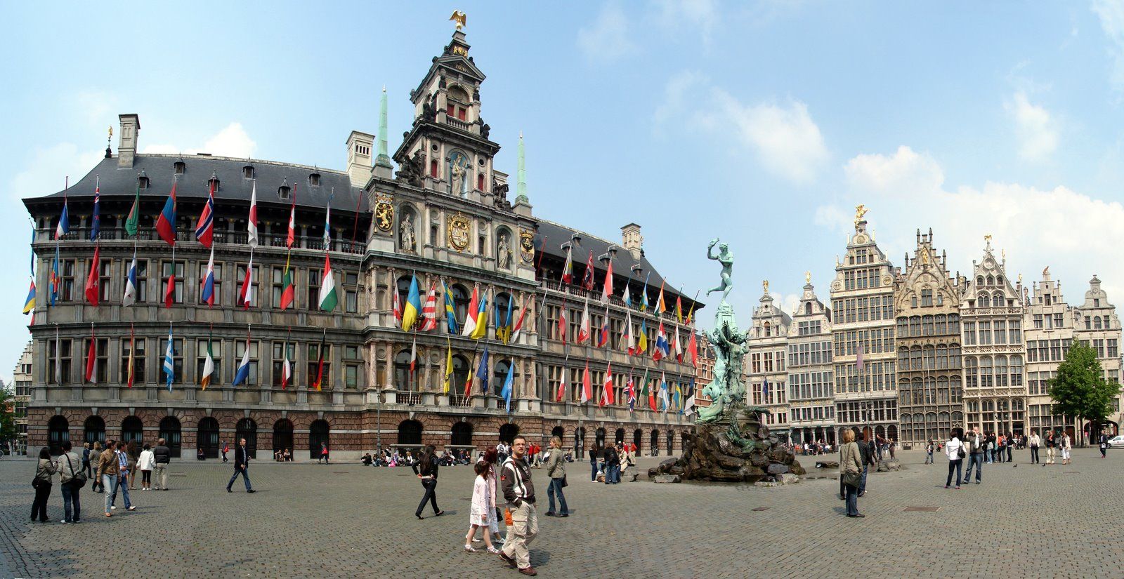
安特卫普位于比利时西北部斯海尔德河畔,是比利时最大港口和重要工业城市,面积140平方公里,人口45.7万人(2005年1月),居民大多使用荷兰地方方言,工商界主要使用法语。安特卫普是欧洲著名文化中心,是著名艺术大师罗宾斯和冯·狄克的诞生地,也是世界著名的游览城市。人们被其吸引的是它的三大看点:一是保存完好、充满中世纪情调的旧市区古老建筑;二是神秘的钻石加工和交易;三是有世界声誉的绘画艺术和众多的博物馆,建有罗宾斯故居博物馆、皇家艺术博物馆、国家海运博物馆以及钻石博物馆等。(Quelle:http://baike.baidu.com)
Antwerpen (veraltet deutsch Antorf oder Antorff, französisch Anvers) ist eine Hafenstadt in der Region Flandern in Belgien und die Hauptstadt der Provinz Antwerpen. Bezogen auf die Stadt als Verwaltungseinheit ist Antwerpen die größte Stadt des Landes. Die Agglomeration Antwerpen ist nach der Region Brüssel-Hauptstadt die zweitgrößte in Belgien.
Von großer internationaler Bedeutung ist Antwerpen durch seinen Seehafen, den zweitgrößten Europas, sowie als weltweit wichtigstes Zentrum für die Verarbeitung und den Handel von Diamanten.
Antwerpen war im 15. und 16. Jahrhundert eine der größten Städte der Welt, zeitweise die wichtigste Handelsmetropole Europas und als bedeutendes kulturelles Zentrum Wirkungsstätte von Künstlern wie Rubens. Antwerpen war Austragungsort der Olympischen Sommerspiele 1920 und Kulturhauptstadt Europas 1993. Das Druckereimuseum Plantin-Moretus, das Maison Guiette und der Turm der Liebfrauenkathedrale gehören zum UNESCO-Welterbe.
アントウェルペン(オランダ語: Antwerpen [ˈɑntʋɛrpə(n)] (![]() 音声ファイル), フランス語: Anvers [ɑ̃vɛʁ(s)], 英語: Antwerp [ˈæntwɜrp])は、ベルギーのフランデレン地域・アントウェルペン州の州都で、同国最大の都市(首都圏地域の人口を合わせればブリュッセル市が最大)。英語名に由来するアントワープや、フランス語名に由来するアンヴェルス(アンベルス)[1]も日本語の表記においてよく用いられる。2012年1月1日の総人口は502,604人。面積は204.51 km2, 人口密度は2,457.56人/km2である。
音声ファイル), フランス語: Anvers [ɑ̃vɛʁ(s)], 英語: Antwerp [ˈæntwɜrp])は、ベルギーのフランデレン地域・アントウェルペン州の州都で、同国最大の都市(首都圏地域の人口を合わせればブリュッセル市が最大)。英語名に由来するアントワープや、フランス語名に由来するアンヴェルス(アンベルス)[1]も日本語の表記においてよく用いられる。2012年1月1日の総人口は502,604人。面積は204.51 km2, 人口密度は2,457.56人/km2である。
Antwerp (/ˈæntwɜːrp/ (![]() listen), Dutch: Antwerpen [ˈɑntʋɛrpə(n)] (
listen), Dutch: Antwerpen [ˈɑntʋɛrpə(n)] (![]() listen), French: Anvers [ɑ̃vɛʁ(s)]) is a city in Belgium, and is the capital of Antwerp province in Flanders. With a population of 520,504,[2] it is the most populous city proper in Belgium. Its metropolitan area houses around 1,200,000 people, coming in second behind Brussels.[3][4]
listen), French: Anvers [ɑ̃vɛʁ(s)]) is a city in Belgium, and is the capital of Antwerp province in Flanders. With a population of 520,504,[2] it is the most populous city proper in Belgium. Its metropolitan area houses around 1,200,000 people, coming in second behind Brussels.[3][4]
Antwerp is on the River Scheldt, linked to the North Sea by the Westerschelde estuary. It is about 40 kilometres (25 mi) north of Brussels, and about 15 kilometres (9 mi) from the Dutch border. The Port of Antwerp is one of the biggest in the world, ranking second in Europe[5][6] and within the top 20 globally.[7] Antwerp was also the place of the world's oldest stock exchange building, originally built in 1531 and re-built in 1872.[8]
Antwerp has long been an important city in the Low Countries, both economically and culturally, especially before the Spanish Fury (1576) in the Dutch Revolt. The inhabitants of Antwerp are nicknamed Sinjoren ([sɪnˈjoːˌrən]), after the Spanish honorific señor or French seigneur, "lord", referring to the Spanish noblemen who ruled the city in the 17th century.[9] Today Antwerp is a major trade and cultural centre. The city hosted the 1920 Summer Olympics.
Anvers (prononcé /ɑ̃.vɛʁs/1,2, ou /ɑ̃.vɛʁ/3, en néerlandais : Antwerpen) est une ville belge dans la Région flamande, chef-lieu de la province d'Anvers et de l'arrondissement administratif du même nom, située au cœur de la Dorsale européenne.
Au 1er avril 2017, la commune d’Anvers était la plus peuplée de Belgique, devant Gand et Charleroi, avec 521 216 habitants4, 259 740 hommes et 261 476 femmes, soit une densité de 1 270,06 habitants/km2. L’agglomération anversoise compte, elle, 1 250 000 habitants. C'est la deuxième plus peuplée de Belgique, après Bruxelles. C'est également la troisième commune et ville de Belgique pour ce qui est de la superficie, avec 204,51 km2, juste après Tournai et Couvin.
Archétype de la ville bourgeoise-marchande depuis le Bas Moyen Âge elle constitue alors, selon Fernand Braudel, le centre du commerce international et de la haute finance tout au long du XVIe siècle. Anvers abrite depuis 1931 le plus vieux et unique gratte-ciel d'Europe jusqu'en 1949, la Boerentoren, et dispute à Venise l'invention de la comptabilité en partie double. Anvers est connue pour abriter les plus prestigieux diamantaires de la Planète, avec Londres et Amsterdam, ainsi que la plus importante bourse de diamants de la Planète, la Antwerpse Diamantkring. Elle abrite également une grande concentration d'établissements d'audit et consulting. Enfin, le Port d'Anvers (deuxième port commercial d'Europe en termes d'activités et de tonnage, après celui voisin de Rotterdam) joue un rôle majeur dans la mondialisation des activités économiques européennes.
Les codes postaux vont de 2000 à 2600 à l’intérieur du district de la ville d’Anvers, située principalement sur la rive droite de l’Escaut et connue pour son port international de marchandises extrêmement développé, aujourd'hui le deuxième plus grand d'Europe en termes de volume de marchandises.
Les Anversois sont aussi appelés les Sinjoren, de l’espagnol señor, héritage de l'époque où elle faisait partie de l'Empire habsbourgeois de Charles Quint. La ville est souvent appelée ’t Stad (« La Ville ») et parfois de koekenstad (« la Ville des biscuits ») par allusion aux koffiekoeken (biscuits recouverts d'un fin glaçage au café) d’Anvers, réputées dans toute la Belgique.
Anversa (Antwerpen in olandese, Anvers in francese) è una città di 506.922 abitanti del Belgio settentrionale, la più importante nella regione delle Fiandre, una delle tre regioni dello Stato, e il capoluogo della provincia omonima.
Amberes (en neerlandés, Antwerpen ![]() [ˈɑntˌʋɛrpə(n)] (?·i), en francés, Anvers [ɑ̃ˈvɛʁ(s)]), antiguamente conocida como Antuerpia, es una ciudad situada en Bélgica que posee 521.600 habitantes en 2018. El área metropolitana cubre 1.449 km² (559 millas cuadradas) con un total de 2.190.769 habitantes, según el censo del 1 de enero de 2017.
[ˈɑntˌʋɛrpə(n)] (?·i), en francés, Anvers [ɑ̃ˈvɛʁ(s)]), antiguamente conocida como Antuerpia, es una ciudad situada en Bélgica que posee 521.600 habitantes en 2018. El área metropolitana cubre 1.449 km² (559 millas cuadradas) con un total de 2.190.769 habitantes, según el censo del 1 de enero de 2017.
Антве́рпен (нидерл. Antwerpen [ˈɑntˌʋɛrpə(n)], фр. Anvers [ɑ̃vɛʁs], з.-флам. Antwerpn) — город во Фламандском регионе Бельгии. Второй (после Брюсселя) город страны, самый большой город Фландрии. Административный центр провинции Антверпен. Город расположен на обоих берегах реки Шельды. Морской порт, входит в двадцатку крупнейших портов мира и является вторым в Европе после порта города Роттердама в Нидерландах[2].
 Eurovision Song Contest,ESC

 History
 Greece

 International cities
 *European Capital of Culture
 Olympic Summer Games
 Silk road

 World Heritage

 Important port
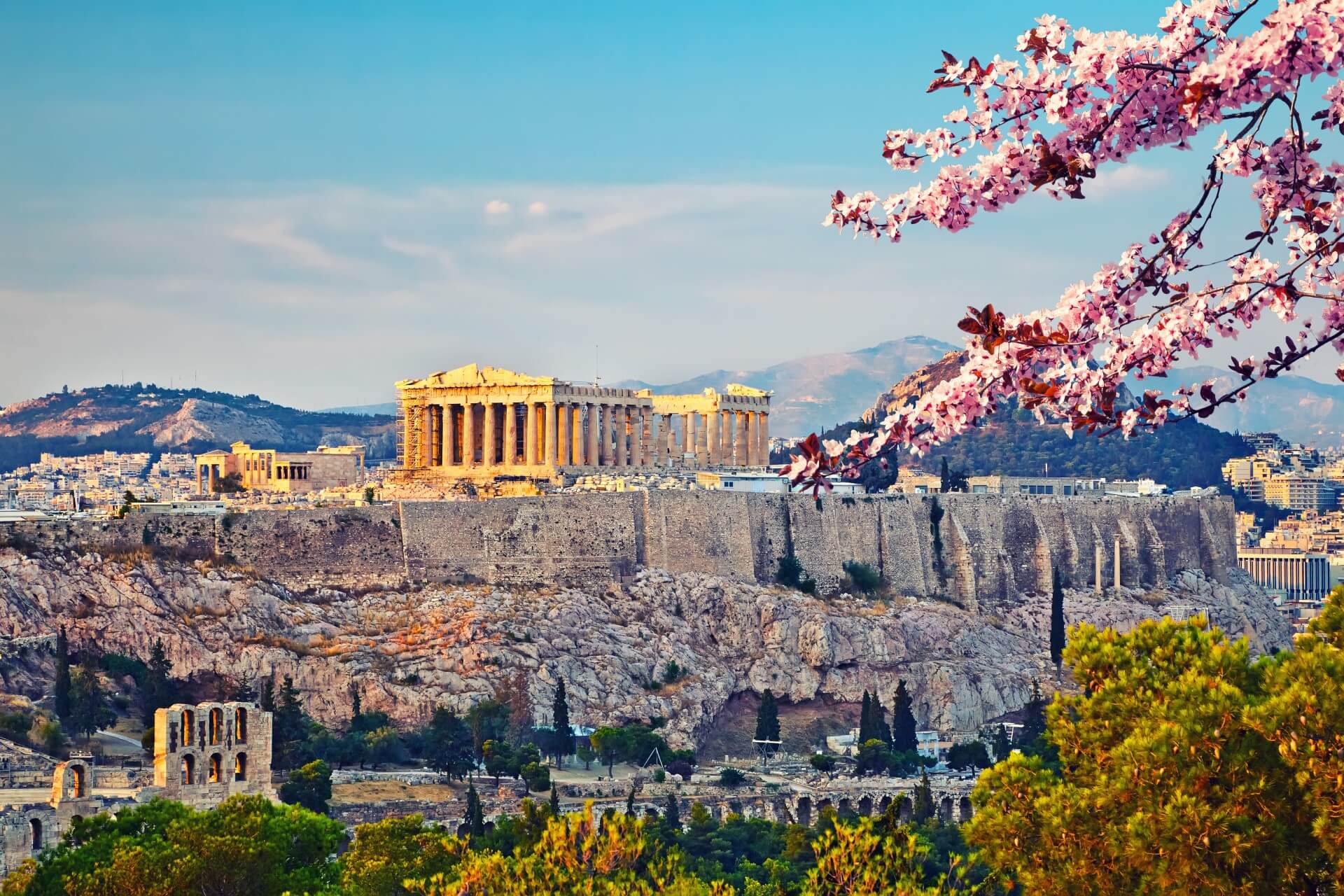
雅典建城至今已经有5000多年的历史,公元前8世纪,爱奥尼亚人建成的雅典是古希腊城邦的盟主。古代雅典是西方文化的源泉,雅典人对艺术、哲学、法律、科学作出了杰出的贡献。公元前5世纪为雅典的鼎盛时期,出现了许多不朽的大师。大悲剧家欧里庇德斯、大喜剧家阿里斯托芬、哲学家苏格拉底、柏拉图、亚里斯多德、历史学家希罗多德等都在这里诞生或居住过,这些光辉的名字照耀着人类文化的黎明。
雅典是希腊的古文物中心,至今仍保存着很多古代文化遗址,如今仍能显出当年的雄伟气概。雅典的博物馆世界驰名。
跨越时空两千五百年正是雅典给人的感觉,山丘上的卫城是西元前五百年的伟大艺术杰作,而山下的波拉卡区千年来就是一本希腊人的生活宝库,而身为希腊的首都及最大的城市,雅典的现代化建筑,拥挤的交通和空气污染严重,又和世界一般大都会无异。
现在雅典是全世界旅游爱好者的度假胜地。蔚蓝的爱琴海边涛声依旧,雅典的一砖一砾都闪烁着人类文明的光辉。 (Quelle:http://eur.bytravel.cn)
雅典(希腊语:Αθήνα,Athína,[aˈθina];古希腊语:Άθῆναι,转写:Athēnai)是希腊首都,也是希腊最大的城市。雅典位于巴尔干半岛南端,三面环山,一面傍海,西南距爱琴海法利龙湾8公里,属亚热带地中海气候。基菲索斯河和伊利索斯河穿城而过。市内多小山。
雅典是世界上最老的城市之一,有记载的历史就长达3000多年。现在雅典是欧洲第八大城市[1]。雅典是希腊经济、财政、工业、政治和文化中心。雅典也是欧盟商业中心之一。市区人口330万,加上郊区人口共有380万人口。城市的面积为39平方公里,加上郊区为412平方公里。[2]
古雅典是一个强大的城邦,是驰名世界的文化古城。希腊是西方哲学的摇篮,是柏拉图学院和亚里士多德的讲学场所的所在地。[3][4]苏格拉底、希罗多德、伯里克利、索福克勒斯、阿里斯托芬、欧里庇得斯、埃斯库罗斯和其他著名的哲学家、政治家和文学家都在雅典诞生或居住过[5],雅典也因此被称作“西方文明的摇篮”和民主的起源地。[6]公元前5世纪和4世纪在文化和政治上的成就对欧洲及世界文化产生重大影响。[7]
雅典至今仍保留了很多历史遗迹和大量的艺术作品,其中最著名的是雅典卫城的帕提农神庙,是西方文化的象征。
雅典是现代奥运会起源的地方。1896年曾举办过第一届夏季奥运会。2004年,第二十八届夏季奥林匹克运动会在雅典举行。Athen – neugriechisch Αθήνα [aˈθina] (f. sg.), Katharevousa und altgriechisch Ἀθῆναι Athênai (f. pl.) – ist die Hauptstadt Griechenlands. Athen ist die bevölkerungsreichste und flächengrößte Stadt des Landes. Die Gemeinde Athen im Zentrum des Ballungsraums Athen-Piräus ist dabei relativ klein. Athen im weiteren Sinne umfasst das Gebiet der Regionalbezirke Athen-Zentrum (87,3 km²), Athen-Nord (138,79 km²), Athen-Süd (68,9 km²), Athen-West (66,8 km²) und einiger umliegender Vororte mit zusammen 3,753 Mio. Einwohnern.[2]
Als kulturelles, historisches und wirtschaftliches Zentrum des Landes ist Athen auch die bedeutendste Metropole Griechenlands. Der Flughafen ist der wichtigste des Landes und der acht Kilometer vom Athener Zentrum entfernte Hafen Piräus der größte Griechenlands. Von hier und vom kleineren Rafina wird auch der Schiffsverkehr zu den zahlreichen griechischen Inseln abgefertigt. Im Schienenverkehr hat Athen nationale, jedoch keine internationale Bedeutung.
Die Stadt ist seit der Jungsteinzeit kontinuierlich besiedelt[3] und damit eine der ältesten Siedlungen und Städte Europas. 1985 wurde Athen erste Kulturhauptstadt Europas. In die Liste des Weltkulturerbes der UNESCO wurde 1987 die Akropolis und 1990 das Kloster Daphni aufgenommen.
Athen war in der klassischen Zeit Ort der attischen Polis. Die in dieser Zeit (5. Jahrhundert v. Chr.) entstandene attische Demokratie gilt als Begründerin einer auf dem Prinzip der Volkssouveränität gegründeten politischen Ordnung.
アテネ(現代ギリシア語: Αθήνα; Athína; IPA: [aˈθina]; カサレヴサ: Ἀθῆναι, Athinai; 古代ギリシア語: Ἀθῆναι, Athēnai)は、ギリシャ共和国の首都で同国最大の都市である。
アテネはアッティカ地方にあり、世界でももっとも古い都市の一つで約3,400年の歴史がある。古代のアテネであるアテナイは強力な都市国家であったことで知られる。芸術や学問、哲学の中心で、プラトンが創建したアカデメイアやアリストテレスのリュケイオン[1][2]があり、西洋文明の揺籃や民主主義の発祥地として広く言及されており[3][4]、その大部分は紀元前4-5世紀の文化的、政治的な功績により後の世紀にヨーロッパに大きな影響を与えたことは知られている。[5]今日の現代的なアテネは世界都市としてギリシャの経済、金融、産業、政治、文化生活の中心である。2008年にアテネは世界で32番目に富める都市に位置し[6]、UBSの調査では25番目に物価が高い都市[7]に位置している。
アテネ市の人口は655,780人[8](2004年は796,442人)[9]、市域面積は39 km2 (15 sq mi)[10]である。アテネの都市的地域(大アテネや大ピラエウス)は市域を超えて広がっており、人口は2011年現在3,074,160人に達し[11]、都市的地域の面積は412 km2 (159 sq mi)[10]である。ユーロスタットによれば大都市圏地域(Larger Urban Zones,LUZ) (en) の人口は欧州連合域内では7番目に大きい。
古典ギリシアの文化的遺産は今でもはっきりとしており、多くの古代遺跡や芸術作品が象徴している。もっとも有名で代表的なものにはパルテノン神殿があり初期の西洋文明の鍵となるランドマークと見なされる場合もある。アテネにはローマ帝国支配下のギリシャやビザンティンの遺跡もあり同様に少数のオスマン帝国の遺跡も残されているなど、何世紀にもわたる長い歴史を投影するモニュメントとなっている。アテネには2つのユネスコの世界遺産がありアテナイのアクロポリスと中世のダフニ修道院がそうである。現代のランドマークはギリシアが1833年に独立国となりアテネが首都に制定された時のもので、ギリシャ議会の議事堂や3部作(Trilogy )で構成されたギリシア国立図書館、アテネ大学、アテネアカデミーが含まれる。アテネは、最初の近代オリンピックであるアテネオリンピックと、その108年後に開催されたアテネオリンピック (2004年)の2度のオリンピックの舞台である。[12]アテネにはアテネ国立考古学博物館があり、世界最大の古代ギリシアの遺品の収蔵を特徴とし新しい2008年に完成したアクロポリス博物館もある。ギリシャ正教会の首長であるアテネ大主教が所在し、精神的な中心地でもある。(ギリシャ正教会は正教会に属し、クレタ島を除くギリシャ一国を管轄する。)正教会の定めるアテネの守護聖人は、ディオニシオス・オ・アレオパギティス、イェロテオス、フィロセイ。1985年には欧州文化首都に選ばれた。
Athens (/ˈæθɪnz/;[3] Greek: Αθήνα, Athína [aˈθina]; Ancient Greek: Ἀθῆναι, Athênai [a.tʰɛ̂ː.nai̯]) is the capital and largest city of Greece. Athens dominates the Attica region and is one of the world's oldest cities, with its recorded history spanning over 3,400 years[4] and its earliest human presence starting somewhere between the 11th and 7th millennium BC.[5]
Classical Athens was a powerful city-state that emerged in conjunction with the seagoing development of the port of Piraeus, which had been a distinct city prior to its 5th century BC incorporation with Athens. A centre for the arts, learning and philosophy, home of Plato's Academy and Aristotle's Lyceum,[6][7] it is widely referred to as the cradle of Western civilization and the birthplace of democracy,[8][9] largely because of its cultural and political impact on the European continent, and in particular the Romans.[10] In modern times, Athens is a large cosmopolitan metropolis and central to economic, financial, industrial, maritime, political and cultural life in Greece. In 2012, Athens was ranked the world's 39th richest city by purchasing power[11] and the 67th most expensive[12] in a UBS study.
Athens is a global city and one of the biggest economic centres in southeastern Europe. It has a large financial sector, and its port Piraeus is both the largest passenger port in Europe,[13][14][15][16] and the second largest in the world.[17][dead link] The Municipality of Athens (also City of Athens) had a population of 664,046 (in 2011)[2] within its administrative limits, and a land area of 38.96 km2 (15.04 sq mi).[18][19] The urban area of Athens (Greater Athens and Greater Piraeus) extends beyond its administrative municipal city limits, with a population of 3,090,508 (in 2011)[20] over an area of 412 km2 (159 sq mi).[19] According to Eurostat[21] in 2011, the functional urban area (FUA) of Athens was the 9th most populous FUA in the European Union (the 6th most populous capital city of the EU), with a population of 3.8 million people. Athens is also the southernmost capital on the European mainland.
The heritage of the classical era is still evident in the city, represented by ancient monuments and works of art, the most famous of all being the Parthenon, considered a key landmark of early Western civilization. The city also retains Roman and Byzantine monuments, as well as a smaller number of Ottoman monuments. Athens is home to two UNESCO World Heritage Sites, the Acropolis of Athens and the medieval Daphni Monastery. Landmarks of the modern era, dating back to the establishment of Athens as the capital of the independent Greek state in 1834, include the Hellenic Parliament and the so-called "architectural trilogy of Athens", consisting of the National Library of Greece, the National and Kapodistrian University of Athens and the Academy of Athens. Athens is also home to several museums and cultural institutions, such as the National Archeological Museum, featuring the world's largest collection of ancient Greek antiquities, the Acropolis Museum, the Museum of Cycladic Art, the Benaki Museum and the Byzantine and Christian Museum. Athens was the host city of the first modern-day Olympic Games in 1896, and 108 years later it welcomed home the 2004 Summer Olympics, making it one of only a handful of cities to have hosted the Olympics more than once.[22]
Athènes (en grec ancien Ἀθῆναι / Athễnai — le nom est toujours pluriel —, en grec moderne Αθήνα [a'θina] / Athína) est la capitale et la plus grande ville de la Grèce. En 2011, elle compte 664 046 habitants intra-muros sur une superficie de 39 km2. Son aire urbaine, le Grand Athènes, qui comprend notamment le port du Pirée, en compte plus de 3 millions. Berceau de la civilisation occidentale et dotée d'un riche passé, la ville est aujourd'hui le cœur politique, économique et culturel de la République hellénique, dont elle accueille la plupart des institutions, comme le Parlement, l'Áreios Págos (cour suprême) et le siège du Gouvernement.
Athènes est l'une des plus anciennes villes au monde, avec une présence humaine attestée dès le Néolithique. Fondée vers -800 autour de la colline de l'Acropole — par le héros Thésée, selon la légende —, la cité domine la Grèce au cours du Ier millénaire av. J.‑C.. Elle connaît son âge d'or au Ve siècle av. J.-C., sous la domination du stratège Périclès : principale puissance militaire de Grèce, à la tête d'une vaste alliance de cités, elle est également le cœur culturel de la Méditerranée. Première république de l'histoire, la démocratie athénienne connaît une vie intellectuelle importante, rassemblant des philosophes antiques (Socrate, Platon, Aristote), des auteurs de théâtre (Eschyle, Sophocle, Euripide, Aristophane) et l'historien Thucydide. De nombreux témoignages de cette période faste ont été conservés, comme le Parthénon, l'Agora (qui comprend notamment le temple d'Héphaïstos), l'Olympéion, le théâtre de Dionysos ou encore le Stade panathénaïque.
Intégrée au royaume de Macédoine, puis à l'Empire byzantin — période durant laquelle fut bâti le monastère de Daphni —, Athènes est conquise par l'Empire ottoman en 1456 et reste sous sa domination jusqu'en 1822, année de l'indépendance de la Grèce. Elle en devient la capitale et connaît une importante croissance urbaine. Occupée lors des deux guerres mondiales, la ville est ravagée par les destructions de la guerre civile grecque (1946 – 1949). Durant la seconde moitié du XXe siècle, Athènes devient le cœur économique et universitaire d'une Grèce en plein développement, dont les symboles sont les grandes avenues commerçantes telles que l'avenue Kifissias ou l'avenue Vasilissis Sofias. Frappée de plein fouet par la crise grecque depuis 2009, la ville a perdu plusieurs dizaines de milliers d'habitants et fait face à d'importantes difficultés économiques.
La ville s'étend sur la plaine d'Attique, sur les rives de la mer Égée. Elle est le chef-lieu du district régional d'Athènes-Centre et la capitale de la périphérie d'Attique, mais aussi celle du diocèse décentralisé du même nom. Le quartier le plus ancien, Pláka, est situé en contrebas de l'Acropole et comprend notamment la place Monastiráki. Kolonáki est le quartier huppé, à proximité de la place Syntagma. Enfin, Exárcheia est le quartier alternatif et branché de la ville, foyer de l'anarchisme en Grèce et de la contestation populaire depuis la crise. Grâce à son climat méditerranéen et ses nombreux musées, comme le musée de l'Acropole ou le musée national archéologique, Athènes est l'une des principales destinations touristiques d'Europe. Elle a également accueilli les Jeux olympiques d'été en 1896 et en 2004.
Atene (AFI: /aˈtɛne/[2]; in greco Αθήνα, traslitterato in Athína; in greco antico: Ἀθῆναι, Athḕnai)[3] è un comune greco di 655 780 abitanti,[1] capitale della Repubblica Ellenica, capoluogo dell'unità periferica di Atene Centrale e della periferia dell'Attica.
Il comune di Atene, stricto sensu, ha una superficie di 39 km², ma l'area metropolitana intesa come Grande Atene[4] ha un'estensione di 412 km² con 4 013 368 abitanti, ed è così la settima conurbazione più grande dell'Unione europea, e la quinta capitale più popolosa dell'Unione.[5]
Atene è una metropoli cosmopolita ed è il centro economico, finanziario, industriale e culturale della Grecia, e ha una notevole importanza a livello europeo, ma anche mondiale.[6] Nel 2012 è stata classificata come la 39ª città più ricca del mondo per potere d'acquisto[7] e come la 77ª più costosa[8] in una ricerca effettuata dalla società svizzera UBS.
È nota in tutto il mondo per la nascita della democrazia, per essere stata la sede dell'accademia di Platone e del liceo di Aristotele, oltre che aver dato i natali a Socrate, Pericle, Sofocle e molti altri filosofi e personaggi importanti dell'antichità. Tra le città più antiche del mondo,[9] è stata una fiorente polis ed è considerata la culla della civiltà occidentale.[10] Nel XXI secolo è stata al centro dell'attenzione di tutto il mondo per aver organizzato con successo i Giochi della XXVIII Olimpiade nel 2004 e per l'inaugurazione del Nuovo Museo dell'Acropoli nel 2009, che ha riaperto il dibattito riguardante i Marmi del Partenone.
Dall'aprile 2018 all'aprile 2019, Atene sarà capitale mondiale del libro.[11]
La città è anche la sede del Santo Sinodo della Chiesa di Grecia, presso il Monastero di Petraki.
Tradizionalmente la protettrice della città è la dea Atena, raffigurata sia sullo stemma che sulla bandiera della città.
Atenas (griego antiguo: Ἀθῆναι, romanización: Athēnai, griego moderno: Αθήνα, romanización: Athína) es la capital de Grecia y actualmente la ciudad más grande del país. La población del municipio de Atenas es de 664 046 (en 2011), pero su área metropolitana es mucho mayor y comprende una población de 3,8 millones (en 2011). Es el centro principal de la vida económica, cultural y política griega.
La historia de Atenas se extiende más de tres mil años, lo que la convierte en una de las ciudades habitadas más antiguas. Durante la época clásica de Grecia, fue una poderosa ciudad estado que nació junto con el desarrollo de la navegación marítima del puerto de El Pireo y que tuvo un papel fundamental en el desarrollo de la democracia. También fue un centro cultural donde vivieron muchos de los grandes artistas, escritores y filósofos de la Antigüedad. Estas contribuciones de Atenas al pensamiento de su época tuvieron una gran influencia en el desarrollo de Grecia, de Roma y de la cultura occidental.
Atenas es una ciudad rica en restos arqueológicos de extraordinaria importancia, de los cuales el más famoso es el Partenón en la Acrópolis. Además de construcciones de la época clásica griega, también se conservan monumentos romanos y bizantinos, así como varias construcciones modernas notables.
Афи́ны (греч. Αθήνα, МФА: [aˈθina]) — столица Греции. Располагается в исторической области Аттика и является экономическим, культурным и административным центром страны. Город назван в честь богини войны и мудрости Афины, которая была покровителем древнего полиса. Афины имеют богатую историю; в классический период (V век до н. э.) город-государство достигло вершины своего развития, определив многие тенденции развития позднейшей европейской культуры. Так, с городом связаны имена философов Сократа, Платона и Аристотеля, заложивших основы европейской философии, трагиков Эсхила, Софокла и Еврипида, стоявших у истоков драмы; политическим строем древних Афин была демократия.
Площадь территории городской агломерации — 412 км². Эта территория окружена горами: Эгалео, Парнис, Пенделикон и Имитос. Общая численность населения городской агломерации составляет 1/3 от общей численности населения Греции и составляет, в соответствии с переписью 2011 года, 3 090 508 человек. Таким образом плотность населения городской агломерации — 7500 человек на 1 км². Высота центра города над уровнем моря составляет 20 метров, в то время как рельеф территории города очень разнообразен, с равнинами и горами.
 France

 History

 International cities
 *European Capital of Culture
 ITU World Championship Series

 Provence-Alpes-Côte d´Azur

 Sport
Sport
 Triathlon

 World Heritage
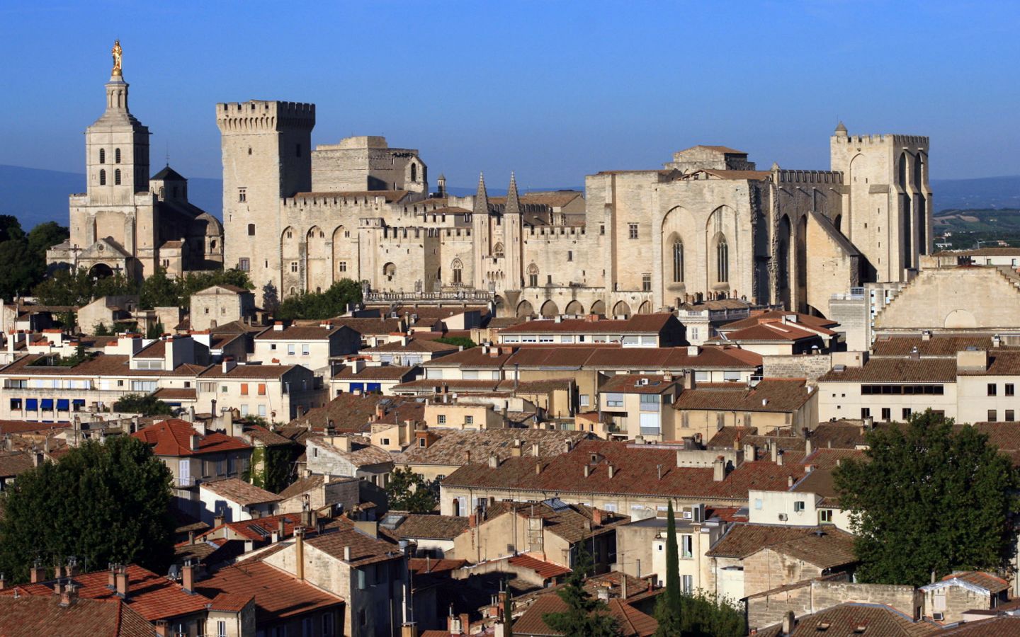
阿维尼翁(法语:Avignon; 加斯科:Avinhon)是位于法国南部普罗旺斯-阿尔卑斯-蓝色海岸大区沃克吕兹省,罗讷河左岸的一座城市。阿维尼翁始建于罗马时 期。现今是法国南部的旅游胜地之一。阿维尼翁城区住户在2011年初为90194人,其中有大约12000人仍居住在古城墙内,已被划为观光区域的老城区 (intra-muros)。如算上四周郊区和附属村镇,阿维尼翁地区的人口超过50万,是法国排名第16位的城市聚落。
在1309到1377年之间,天主教教廷从罗马梵缔冈迁移至此,前后一共有七位教宗在阿维尼翁教廷生活,直到格利高里十一世迁都罗马。后来更出现两地各立教宗的情形(史称“大分裂”)。这段时期也被后世称为阿维尼翁分裂时期。阿维尼翁城原是乔万娜一世的属地,在1348年售予教廷。教廷对阿维尼翁的统治一直延续到1791年法国大革命之时,其后阿维尼翁成为法国的一部分。阿维尼翁是沃克吕兹省的省会,也是法国少见的保留了城墙的城市。城墙内有为教宗修筑的教皇宫。此外著名古迹还有阿维尼翁圣母大教堂、圣贝内泽桥等。1995年以阿维尼翁历史城区之名被列入世界文化遗产。
Avignon [aviˈɲɔ̃] (oc. Avinhon bzw. Avignoun [aviˈɲũn]) ist eine Stadt und Gemeinde in der Provence in Südfrankreich am östlichen Ufer der Rhône mit 92.130 Einwohnern (Stand 1. Januar 2015), von denen etwa 15.000 innerhalb der Stadtmauern wohnen. Avignon ist Sitz der Präfektur und die größte Stadt des Départements Vaucluse.
Da Avignon von 1309 bis 1376 – und während des nachfolgenden Abendländischen Schismas – Papstsitz war, trägt die Stadt den Beinamen „Stadt der Päpste“. Die Altstadt von Avignon mit ihren prächtigen, mittelalterlichen Häusern ist von einer intakten und imposanten Befestigungsmauer umgeben. Die Altstadt mit dem gotischen Papstpalast (Palais des Papes) aus dem 14. Jahrhundert, der Bischofsanlage, dem Rocher des Doms und der berühmten Brücke, der Pont Saint-Bénézet, zählt zum UNESCO-Weltkulturerbe.
Künstlerisch und kulturell ist die Stadt durch das Festival von Avignon auch weit über die französischen Landesgrenzen hinaus bekannt. Im Jahr 2000 war Avignon Kulturhauptstadt Europas.
アヴィニョン(Avignon)は、フランスの南東部に位置する都市(コミューン)で、ヴォクリューズ県の県庁所在地である。ローマ帝国時代にはガリア・ナルボネンシス属州の主要都市の一つであった。5世紀に蛮族の侵入によって荒廃した後、737年にカール・マルテル率いるフランク人によって滅ぼされた。カール・マルテルが戦っていたアラブ人の側についたことによる。その後、ブルグント王国、ついでアルル王国領となる。12世紀末、都市は独立を宣言し、共和制をとる都市国家となるが、長くは続かず、アヴィニョンはプロヴァンス伯領、次いでトゥールーズ伯領となった。中世末のカタリ派運動の中ではカタリ派を支持した結果、1226年にアルビジョア十字軍を率いたフランス王ルイ8世によって占領され、武装解除された。カタリ派を支持した街への処罰として、市の城壁は破壊された。
キリスト教が入ったのは早く、70年に司教座が置かれた。1309年にローマ教皇クレメンス5世がアヴィニョンを居所に定め、1377年まで教皇庁所在地とした(アヴィニョン捕囚)。1426年に大司教座がおかれた。1303年にアヴィニョン大学が開かれ、フランス革命まで続き、法学で知られた。
アヴィニョン捕囚時代の半ば、1348年に領主プロヴァンス伯(兼ナポリ女王)ジョアンナから教皇クレメンス6世にアヴィニョンが売却された。以後、フランス革命で没収されるまでアヴィニョンは教皇領となった。何人かの対立教皇は、アヴィニョンに教皇座を置いている。
Avignon (French pronunciation: [avi'ɲɔ̃]; Latin: Avenio; Provençal: Avignoun, Occitan: Avinhon pronounced [aviˈɲun]) is a commune in south-eastern France in the department of Vaucluse on the left bank of the Rhône river. Of the 90,194 inhabitants of the city (as of 2011), about 12,000 live in the ancient town centre enclosed by its medieval ramparts.
Between 1309 and 1377, during the Avignon Papacy, seven successive popes resided in Avignon and in 1348 Pope Clement VI bought the town from Joanna I of Naples. Papal control persisted until 1791 when, during the French Revolution, it became part of France. The town is now the capital of the Vaucluse department and one of the few French cities to have preserved its ramparts.
The historic centre, which includes the Palais des Papes, the cathedral, and the Pont d'Avignon, became a UNESCO World Heritage Site in 1995. The medieval monuments and the annual Festival d'Avignon have helped to make the town a major centre for tourism.
Avignon [a.viˈɲɔ̃] est une ville du Sud de la France, située au confluent du Rhône et de la Durance. C'est la ville où siège le conseil du Grand Avignon. Avignon est le chef-lieu de l'arrondissement d'Avignon et du département de Vaucluse. Ses habitants s'appellent les Avignonnais.
Par sa population, Avignon constitue la seizième aire urbaine de France et fait partie des villes moyennes, elle est la 45e ville de France sur les 34 672 villes et communes du pays. Elle comptait 92 209 habitants lors de son dernier recensement.
Surnommée la « cité des papes » en raison de la présence des papes de 1309 à 1423, elle est actuellement la plus grande ville et la préfecture du département de Vaucluse.
C'est l'une des rares villes françaises à avoir conservé ses remparts, son centre historique, composé du Palais des Papes, de l'ensemble épiscopal, du Rocher des Doms et du pont d’Avignon. Elle a été classée patrimoine mondial de l'UNESCO sous les critères I, II et IV.
La renommée de son festival, le plus grand du monde et véritable vitrine artistique et culturelle de la ville, a largement dépassé les frontières françaises. La ville fut capitale européenne de la culture en 2000.
Avignon comporte un cœur étudiant important, notamment grâce à son quartier étudiant : Agroparc ainsi que de son université : l'Université d'Avignon et des Pays de Vaucluse.
Avignone (Avignon in francese, Avignoun in provenzale in grafia mistraliana, Avinhon in occitano in grafia classica), è una città della Francia meridionale, la prefettura del dipartimento di Vaucluse, di cui è il capoluogo, nella regione amministrativa della Provenza-Alpi-Costa Azzurra. Si affaccia sulla riva sinistra del Rodano. I suoi abitanti si chiamano avignonesi (avignonnais).
Aviñón3 (en francés Avignon, en occitano provenzal Avinhon [en norma clásica] o Avignoun [en norma mistralense]) es una ciudad y comuna francesa, capital del departamento de Vaucluse, en la región de Provenza-Alpes-Costa Azul.
Авиньо́н[2][3] (фр. Avignon [aviˈɲɔ̃], окс. Avinhon, лат. Aven(n)io) — коммуна на юго-востоке Франции, префектура (главный город) округа Авиньон и департамента Воклюз в регионе Прованс — Альпы — Лазурный Берег, кантоны Авиньон-1, Авиньон-2, Авиньон-3[4]. Город расположен на левом берегу Роны, является местом проведения одного из крупнейших международных ежегодных театральных фестивалей.
 Eurovision Song Contest,ESC

 International cities
 *European Capital of Culture
 Norwegen

 World Heritage


 Berlin
 Germany
 FIFA Fussball-Weltmeisterschaft 2006

 UEFA European Championship 2024
 Women's Soccer World Cup 2011

 Geography

 Geography
 *World's Most Livable Cities

 History

 International cities
 *European Capital of Culture
 League of Legends
 League of Legends World Championship
 Olympic Summer Games
 Silk road

 Vacation and Travel

 World Heritage
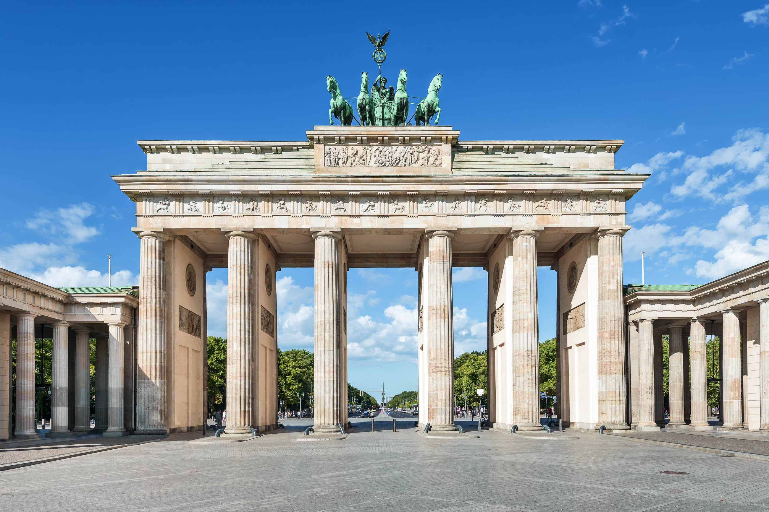
柏林(德语:Berlin,德语发音: [bɛɐ̯ˈliːn] (![]() listen))是德国首都,也是德国最大的城市,现有居民约340万人。柏林位于德国东北部,四面被勃兰登堡州环绕,施普雷河和哈维尔河流经该市。柏林也是德国十六个联邦州之一,和汉堡、不来梅同为德国僅有的三個的城市州。
listen))是德国首都,也是德国最大的城市,现有居民约340万人。柏林位于德国东北部,四面被勃兰登堡州环绕,施普雷河和哈维尔河流经该市。柏林也是德国十六个联邦州之一,和汉堡、不来梅同为德国僅有的三個的城市州。
柏林是欧盟區內人口第2多的城市以及城市面积第8大的城市。它是柏林-勃兰登堡都会区的中心,有来自超过190个国家的5百万人口。地理上位于欧洲平原,受温带季节性气候影响。城市周围三分之一的土地由森林、公园、花园、河流和湖泊组成。
该市第一次有文字记载是在13世纪,柏林连续的成为以下这些国家的首都:普鲁士王国(1701年-1870年)、德意志帝国(1871年-1918年)、魏玛共和国(1919年-1933年)、納粹德國(1933年-1945年)。在1920年代,柏林是世界第3大自治市。第二次世界大战后,城市被分割;东柏林成为了东德的首都,而西柏林事实上成为了西德在东德的一块飛地,被柏林墙围住。直到1990年两德统一,该市重新获得了全德国首都的地位,驻有147个外国大使馆。
柏林无论是从文化、政治、传媒还是科学上讲都称的上是世界级城市。该市经济主要基于服务业,包括多种多样的创造性产业、传媒集团、议会举办地点。柏林扮演了一个欧洲大陆上航空与铁路运输交通枢纽的角色,同时它也是欧盟内游客数量最多的城市之一。主要的产业包括信息技术、制药、生物工程、生物科技、光学电子、交通工程和可再生能源。
柏林都会区有知名大学、研究院、体育赛事、管弦乐队、博物馆和知名人士。城市的历史遗存使该市成为国际电影产品的交流中心。该市在节日活动、建筑的 多样化、夜生活、当代艺术、公共交通网络以及高质量生活方面得到了广泛认可。柏林已经发展成一个全球焦点城市,以崇尚自由生活方式和现代精神的年轻人和艺 术家而闻名。
Berlin ![]() [bɛɐ̯ˈliːn] ist die Bundeshauptstadt der Bundesrepublik Deutschland und zugleich eines ihrer Länder.[12] Die Stadt Berlin ist mit rund 3,6 Millionen Einwohnern die bevölkerungsreichste und mit 892 Quadratkilometern die flächengrößte Gemeinde Deutschlands.[5] Sie bildet das Zentrum der Metropolregion Berlin/Brandenburg (rund 6 Millionen Einwohner) und der Agglomeration Berlin (rund 4,5 Millionen Einwohner). Der Stadtstaat besteht aus zwölf Bezirken. Neben den Flüssen Spree und Havel befinden sich im Stadtgebiet kleinere Fließgewässer sowie zahlreiche Seen und Wälder.
[bɛɐ̯ˈliːn] ist die Bundeshauptstadt der Bundesrepublik Deutschland und zugleich eines ihrer Länder.[12] Die Stadt Berlin ist mit rund 3,6 Millionen Einwohnern die bevölkerungsreichste und mit 892 Quadratkilometern die flächengrößte Gemeinde Deutschlands.[5] Sie bildet das Zentrum der Metropolregion Berlin/Brandenburg (rund 6 Millionen Einwohner) und der Agglomeration Berlin (rund 4,5 Millionen Einwohner). Der Stadtstaat besteht aus zwölf Bezirken. Neben den Flüssen Spree und Havel befinden sich im Stadtgebiet kleinere Fließgewässer sowie zahlreiche Seen und Wälder.
Urkundlich erstmals im 13. Jahrhundert erwähnt, war Berlin im Verlauf der Geschichte und in verschiedenen Staatsformen Residenz- und Hauptstadt Brandenburgs, Preußens und des Deutschen Reichs. Ab 1949 war der Ostteil der Stadt Hauptstadt der Deutschen Demokratischen Republik. Mit der deutschen Wiedervereinigung im Jahr 1990 wurde Berlin wieder gesamtdeutsche Hauptstadt und in der Folge Sitz der Bundesregierung, des Bundespräsidenten, des Bundestages, des Bundesrates sowie zahlreicher Bundesministerien und Botschaften.
Zu den bedeutenden Wirtschaftszweigen in Berlin gehören unter anderem der Tourismus, die Kreativ- und Kulturwirtschaft, die Biotechnologie und Gesundheitswirtschaft mit Medizintechnik und pharmazeutischer Industrie, die Informations- und Kommunikationstechnologien, die Bau- und Immobilienwirtschaft, der Handel, die Optoelektronik, die Energietechnik sowie die Messe- und Kongresswirtschaft. Die Stadt ist ein europäischer Knotenpunkt des Schienen- und Luftverkehrs. Berlin zählt zu den aufstrebenden, internationalen Zentren für innovative Unternehmensgründer und verzeichnet jährlich hohe Zuwachsraten bei der Zahl der Erwerbstätigen.[13]
Berlin gilt als Weltstadt der Kultur, Politik, Medien und Wissenschaften.[14][15][16][17] Die Universitäten, Forschungseinrichtungen, Sportereignisse und Museen Berlins genießen internationalen Ruf.[18] Die Metropole trägt den UNESCO-Titel Stadt des Designs und ist eines der meistbesuchten Zentren des Kontinents.[19] Berlins Architektur, Festivals, Nachtleben und vielfältige Lebensbedingungen sind weltweit bekannt.[20]
ベルリン(独: Berlin ドイツ語発音: [bɛɐ̯ˈliːn] (![]() 音声ファイル)、伯林)は、ドイツ北東部、ベルリン・ブランデンブルク大都市圏地域の中心に位置する都市である。16ある連邦州のうちの一つで、市域人口は350万人[1]とドイツでは最大の都市で欧州連合の市域人口ではロンドンに次いで2番目に多く、都市的地域の人口は7番目に多い。[3]同国の首都と定められている[4]。
音声ファイル)、伯林)は、ドイツ北東部、ベルリン・ブランデンブルク大都市圏地域の中心に位置する都市である。16ある連邦州のうちの一つで、市域人口は350万人[1]とドイツでは最大の都市で欧州連合の市域人口ではロンドンに次いで2番目に多く、都市的地域の人口は7番目に多い。[3]同国の首都と定められている[4]。
ベルリンが属するベルリン・ブランデンブルク大都市圏地域の人口は590万人に達し[6]、190カ国を超える海外出身者も暮らす[7]。ベルリンはヨーロッパ平原に位置し温帯の季節的な気候の影響を受ける。市域の3分の1は森林、公園、庭園、河川や湖で構成されている[8]。ベルリンが最初に文書に言及されたのは13世紀のことで、それ以後プロイセン王国(1701-1918)やドイツ帝国(1871-1918)、ヴァイマル共和政(1919-1933)、ナチス・ドイツ(1933-1945)の首都であった[9]。1920年には「大ベルリン」の成立により市域が大幅に拡大し、現在とほぼ同じ領域となった。1920年代には世界で3番目に大きな都市であった[10]。第二次世界大戦後、ベルリンは東ドイツの首都である東ベルリンと、西ドイツの事実上の飛び地で周辺をベルリンの壁(1961-1989)で囲まれた西ベルリンに分断された[11]。1990年のドイツ再統一によりベルリンは再び首都としての地位を得て[12]、147の大使館が置かれる[13][14]。ベルリンは文化や政治、メディア、科学の世界都市である[15][16][17]。アメリカのシンクタンクが2017年に発表した総合的な世界都市ランキングにおいて、世界14位の都市と評価された[18]。
経済的にはサービス産業を基盤とし創造産業やメディア産業、コンベンション会場などが包括されている。ベルリンはまた、欧州大陸の航空や鉄道交通の中枢でもあり[19][20] 、代表的な観光地である。重要な産業にはIT、製薬、生物医学技術、生物工学、電子工学、交通工学、再生可能エネルギーが含まれる。 ベルリンは有名な大学や調査機関、管弦楽団、博物館、著名人が本拠としており多くのスポーツイベントも催されている他[21]、都市の光景や歴史的な遺産は国際的な映画製作には人気な場所となっている[22]。ベルリンでは多く祭典や多様な建築、ナイトライフ、現代芸術、公共交通機関の路線網、世界で最も居住に適した都市など様々な分野でも良く知られた都市である[23]。
ドイツ最大の都市であり立法・行政の中心地ではあるが、地方分権の歴史が長いドイツでは、司法の中心地はカールスルーエ、金融と交通の中心地はフランクフルト、産業の中心地はルール地方、ミュンヘン、シュトゥットガルト、ケルンとされ、東京(日本)やソウル(韓国)、パリ(フランス)のような一極集中という状態はない[24]。戦間期には科学技術や文学、哲学、芸術などが発展しヴァイマル文化によりドイツはもっとも進んだ国となった[25][26]。1988年の欧州文化首都に選ばれている[27]。現代の都市ベルリンは発展の一方で、特に東側の人口停滞などから都市構造の変革が進められている[28]。
Berlin (/bɜːrˈlɪn/; German pronunciation: [bɛɐ̯ˈliːn]) is the capital and the largest city of Germany, as well as one of its 16 constituent states. With a steadily growing population of approximately 3.7 million,[4] Berlin is the second most populous city proper in the European Union behind London and the seventh most populous urban area in the European Union.[5] Located in northeastern Germany on the banks of the rivers Spree and Havel, it is the centre of the Berlin-Brandenburg Metropolitan Region, which has roughly 6 million residents.[6][7][8][9] Due to its location in the European Plain, Berlin is influenced by a temperate seasonal climate. Around one-third of the city's area is composed of forests, parks, gardens, rivers, canals and lakes.[10]
First documented in the 13th century and situated at the crossing of two important historic trade routes,[11] Berlin became the capital of the Margraviate of Brandenburg (1417–1701), the Kingdom of Prussia (1701–1918), the German Empire (1871–1918), the Weimar Republic (1919–1933), and the Third Reich (1933–1945).[12] Berlin in the 1920s was the third largest municipality in the world.[13] After World War II and its subsequent occupation by the victorious countries, the city was divided; West Berlin became a de facto West German exclave, surrounded by the Berlin Wall (1961–1989) and East German territory.[14] East Berlin was declared capital of East Germany, while Bonn became the West German capital. Following German reunification in 1990, Berlin once again became the capital of all of Germany.
Berlin is a world city of culture, politics, media and science.[15][16][17][18] Its economy is based on high-tech firms and the service sector, encompassing a diverse range of creative industries, research facilities, media corporations and convention venues.[19][20] Berlin serves as a continental hub for air and rail traffic and has a highly complex public transportation network. The metropolis is a popular tourist destination.[21] Significant industries also include IT, pharmaceuticals, biomedical engineering, clean tech, biotechnology, construction and electronics.
Berlin is home to world-renowned universities, orchestras, museums, and entertainment venues, and is host to many sporting events.[22] Its Zoological Garden is the most visited zoo in Europe and one of the most popular worldwide. With the world's oldest large-scale movie studio complex, Berlin is an increasingly popular location for international film productions.[23] The city is well known for its festivals, diverse architecture, nightlife, contemporary arts and a very high quality of living.[24] Since the 2000s Berlin has seen the emergence of a cosmopolitan entrepreneurial scene.[25]
Berlin (prononcé [bɛʁ.lɛ̃] ; en allemand Berlin [bɛɐ̯.ˈliːn] Écouter) est la capitale1 et la plus grande ville d'Allemagne. Institutionnellement, c’est une ville-État nommée Land de Berlin.
Située dans le nord-est du pays, Berlin compte environ 3,7 millions d'habitants2. Ses habitants s'appellent les Berlinois. Elle est la deuxième ville et la septième agglomération la plus peuplée de l'Union européenne. L'agglomération de Berlin s'étend sur 892 km2 et compte 4,4 millions d'habitants. La région métropolitaine de Berlin-Brandebourg qui cumule les Länder de Berlin et de Brandebourg regroupe au total près de 6 millions d'habitants.
Fondée au XIIIe siècle, Berlin a été successivement capitale de l'électorat du Brandebourg (1247-1701), du royaume de Prusse (1701-1871), de l'Empire allemand (1871-1918), de la République de Weimar (1919-1933) et du Troisième Reich (1933-1945). Après 1945 et jusqu'à la chute du mur de Berlin en 1989, la ville est partagée en quatre secteurs d'occupation. Pendant la Guerre froide, le secteur soviétique de la ville, nommé Berlin-Est, est devenu la capitale de la République démocratique allemande, tandis que Berlin-Ouest était politiquement rattachée à la République fédérale d'Allemagne, devenant ainsi un bastion avancé du « Monde libre » à l'intérieur du Bloc communiste. Après la chute du mur, Berlin redevint, en 1990, la capitale de l'Allemagne alors réunifiée, et les principales institutions fédérales y emménagèrent en 1999.
Berlin est une ville mondiale culturelle et artistique de premier plan. La ville abrite 166 musées, 142 bibliothèques et 60 théâtres. En 2014, Berlin a accueilli 11,87 millions de visiteurs (+4,8 % plus qu'en 2013)3, dont 4,52 millions de visiteurs étrangers (+5,2 %).
Berlino (AFI: /berˈlino/[2]; in tedesco: Berlin, /bɛɐ̪ ˈliːn/, ) è la maggiore città e anche un Bundesland della Germania, quindi una "città-stato". Capitale federale della Repubblica Federale di Germania e sede del suo governo, è uno dei più importanti centri politici, culturali, scientifici, fieristici e mediatici d'Europa e, dopo Londra, il secondo comune più popoloso dell'Unione europea, con 3.531.201 abitanti.
In passato è stata la capitale della Marca di Brandeburgo (1417-1801), del Regno di Prussia (1701-1918), dell'Impero tedesco (1871-1918), della Repubblica di Weimar (1919-1933) e del Terzo Reich (1933-1945).
L'area metropolitana ha una superficie complessiva di 2.851 km² ed una popolazione di 5.103.778 abitanti, mentre la regione metropolitana di Berlino e Brandeburgo ha una superficie di 30.370 km² ed una popolazione[3] di 7.220.12 abitanti.
Berlín (Berlin en alemán (![]() [bɛɐ̯ˈliːn] (?·i))) es la capital de Alemania y uno de los dieciséis estados federados alemanes. Se localiza al noreste de Alemania. Por la ciudad fluyen los ríos Esprea, Havel, Panke, Dahme y Wuhle. Con una población de 3,5 millones de habitantes, Berlín es la ciudad más poblada del país y de Europa Central, así como la primera ciudad en población y la séptima aglomeración urbana entre los países de la Unión Europea (si bien se convertirá en la sexta una vez la salida del Reino Unido de la Unión Europea se haga efectiva).2
[bɛɐ̯ˈliːn] (?·i))) es la capital de Alemania y uno de los dieciséis estados federados alemanes. Se localiza al noreste de Alemania. Por la ciudad fluyen los ríos Esprea, Havel, Panke, Dahme y Wuhle. Con una población de 3,5 millones de habitantes, Berlín es la ciudad más poblada del país y de Europa Central, así como la primera ciudad en población y la séptima aglomeración urbana entre los países de la Unión Europea (si bien se convertirá en la sexta una vez la salida del Reino Unido de la Unión Europea se haga efectiva).2
Fundada en 1237 como Cölln, Berlín fue sucesivamente capital del Reino de Prusia (1701-1918), de la República de Weimar (1919-1933) y del Tercer Reich (1933-1945). Después de la Segunda Guerra Mundial, la ciudad fue dividida; la parte este de la ciudad se convirtió en la capital de la República Democrática Alemana, mientras que la región oeste de la ciudad se convirtió en un enclave de la República Federal de Alemania en el interior de la Alemania Oriental.
Berlín es una ciudad mundial y un centro cultural y artístico de primer nivel. Es una de las ciudades más influyentes en el ámbito político de la Unión Europea y en 2006 fue elegida Ciudad Creativa por la Unesco.3 En 2009 la ciudad recibió el Premio Príncipe de Asturias de la Concordia.
Берли́н (нем. Berlin [bɛɐ̯ˈliːn], произношение ) — столица и крупнейший город Германии, второй по населению (после Лондона) и пятый по площади город Евросоюза.
Является одной из 16 земель в составе ФРГ. Город расположен на берегах рек:
- Шпрее (в связи с чем его называют «Афинами на Шпрее»),
- Хафель в центре федеральной земли Бранденбург (частью последней Берлин не является с 1920 года).
Около 1200 года на месте современного Берлина располагались два торговых поселения — Кёлльн и Берлин. Точная дата получения ими городских прав неизвестна. Городские права Кёльна впервые упоминаются в 1237 году, городские права Берлина — в 1244 году. В 1307 году города объединились и образовали общую городскую управу. В 1400 году население объединённого Берлина составляло 8000 человек. Историческое название «Кёльн» нашло своё отражение в названии берлинского района Нойкёльн.
Берлин был столицей маркграфства/курфюршества Бранденбургского (с 1417 года), Пруссии (после объединения курфюршества Бранденбург с герцогством Пруссия) и после создания Германской империи стал её столицей.
После Второй мировой войны в соответствии с решениями Ялтинской конференции Берлин, хоть и находился на территории советской зоны оккупации Германии, был разделён четырьмя державами-победительницами на оккупационные секторы. Позднее три сектора оккупации союзников были преобразованы в Западный Берлин, получивший статус особого государственного образования, но безусловно тесно связанного с ФРГ. Передвижение между секторами Берлина длительное время оставалось относительно свободным, и в целях предотвращения утечки населения в западные секторы правительством ГДР было принято решение о возведении Берлинской стены, окружившей с 13 августа 1961 года Западный Берлин. Берлинская стена, ставшая одним из главных символов холодной войны, просуществовала до 1989 года. После объединения Германии в 1990 году её столицей стал воссоединённый Берлин. В 1994 году туда переехала из Бонна администрация президента и в 1999 году — бундестаг и ведомство федерального канцлера вместе с федеральными министерствами.
Сегодня Берлин является мировым культурным центром. Это крупный европейский транспортный узел и один из самых посещаемых городов на континенте. Университеты, исследовательские институты и музеи Берлина известны во всём мире. В городе живут и работают художники, дипломаты и иммигранты со всех уголков планеты.

 Emilia-Romagna
 Bologna
 FIFA Fussball-Weltmeisterschaft 1990

 International cities
 *European Capital of Culture
 Italy
Italy
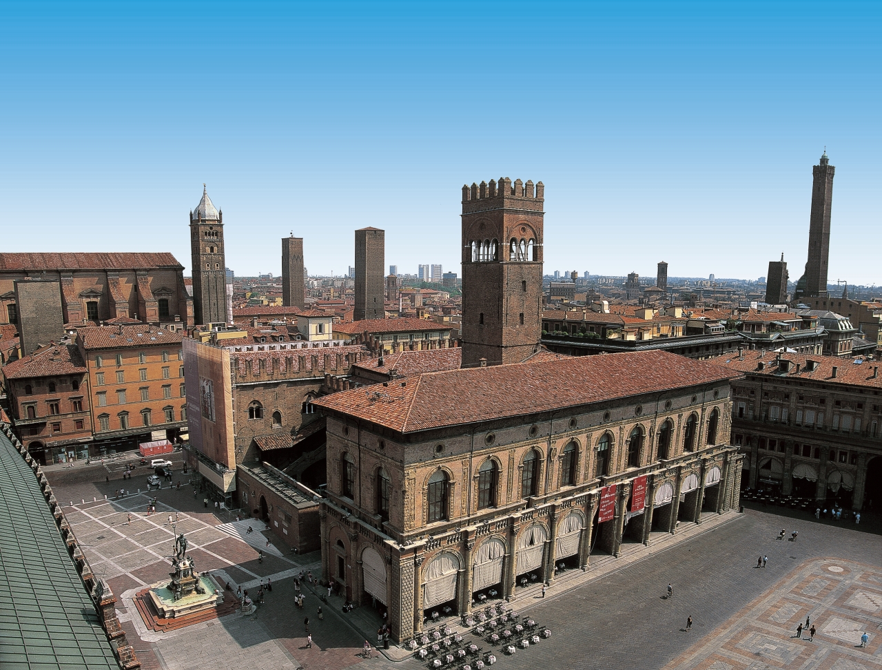
Bologna besitzt eine der schönsten und besterhaltenen Altstädte Europas mit vielen Türmen aus dem Mittelalter und ca. 40 km Arkadengängen, die die weitläufige Innenstadt mit ihren Fußgängerzonen, Plätzen, Kirchen und Palästen miteinander verbinden.
Weit ab vom Massentourismus, dafür mit gut erhaltener Bausubstanz und großartiger Kultur und Geschichte war Bologna im Jahr 2000 zur europäischen Kulturhauptstadt ernannt worden.
Für Motorsportfans ist Bologna und Umgebung ein Mekka, kann man hier die Museen und teilweise auch die Werke von Ducati, Maserati, Lamborghini sowie Ferrari bewundern.
博洛尼亚(意大利语:Bologna)是一座意大利城市,位于北部波河与亚平宁山脉之间,也是艾米利亚-罗马涅的首府。博洛尼亚也是意大利最发达的城市之一。
ボローニャ(イタリア語: Bologna (![]() 音声ファイル))は、イタリア共和国北部にある都市で、その周辺地域を含む人口約39万人の基礎自治体(コムーネ)。エミリア=ロマーニャ州の州都であり、ボローニャ県の県都でもある。
音声ファイル))は、イタリア共和国北部にある都市で、その周辺地域を含む人口約39万人の基礎自治体(コムーネ)。エミリア=ロマーニャ州の州都であり、ボローニャ県の県都でもある。
アペニン山脈とポー川の間にあるポー川谷に位置する。1088年創立と、西欧最古の大学ボローニャ大学(ラテン語名アルマ・マーテル・ストゥディオルム)がある。
Bologna (/bəˈloʊnjə/, also UK: /bəˈlɒnjə/; Italian: [boˈloɲːa] (![]() listen); Emilian: Bulåggna [buˈlʌɲːa]; Latin: Bononia) is the capital and largest city of the Emilia-Romagna Region in Northern Italy. It is the seventh most populous city in Italy, at the heart of a metropolitan area of about one million people.
listen); Emilian: Bulåggna [buˈlʌɲːa]; Latin: Bononia) is the capital and largest city of the Emilia-Romagna Region in Northern Italy. It is the seventh most populous city in Italy, at the heart of a metropolitan area of about one million people.
Of Etruscan origin, the city has been a major urban centre for centuries, first under the Etruscans, then under the Romans (Bononia), then again in the Middle Ages, as a free municipality and signoria, when it was among the largest European cities by population. Famous for its towers, churches and lengthy porticoes, Bologna has a well-preserved historical centre, thanks to a careful restoration and conservation policy which began at the end of the 1970s.[3] Home to the oldest university in the world,[4][5][6][7][8] the University of Bologna, established in AD 1088, the city has a large student population that gives it a cosmopolitan character. In 2000 it was declared European capital of culture[9] and in 2006, a UNESCO "city of music".
Bologna is an important agricultural, industrial, financial and transport hub, where many large mechanical, electronic and food companies have their headquarters as well as one of the largest permanent trade fairs in Europe. According to the most recent data gathered by the European Regional Economic Growth Index (E-REGI) of 2009, Bologna is the first Italian city and the 47th European city in terms of its economic growth rate.[10] As a consequence, Bologna is also one of the wealthiest cities in Italy, often ranking as one of the top cities in terms of quality of life in the country: in 2011 it ranked 1st out of 107 Italian cities.[11]
Bologne (en italien : Bologna, prononcé /boˈloɲa/) est une ville italienne située dans le nord-est du pays, entre le Pô et les Apennins. C'est le chef-lieu de la région d'Émilie-Romagne (plaine du Pô) et de la province de même nom et l'une des principales villes d'Italie. Bologne compte environ 390 000 habitants (les Bolonais2) et son aire urbaine regroupe 1 005 000 habitants.
Elle est considérée comme le siège de la plus ancienne université du monde occidental puisqu'elle a été fondée en 10883. Plus de 900 ans après sa fondation, l'université est encore aujourd'hui le cœur de la ville puisque ses 100 000 étudiants constituent un quart de sa population.
Ce rayonnement culturel et son université lui ont valu le surnom de la Dotta (la savante). La ville possède également d'autres surnoms comme la Rossa (la rouge), en référence à ses tuiles en terre cuite et aussi pour son âme politique de gauche communiste, et la Grassa (la grasse) pour son excellente cuisine.
La sauce bolognaise (ragù alla bolognese en italien) est une recette de la région.
Chaque année au printemps, Bologne accueille un salon du livre de jeunesse de renommée internationale, Foire du livre de jeunesse de Bologne (La Fiera del Libro per Ragazzi).
Bologna (pronuncia: [boˈloɲɲa][4] [5]; Bulåggna [buˈlʌɲɲa] in dialetto bolognese[6]) è un comune italiano di 390 198 abitanti,[2] capoluogo dell'omonima città metropolitana, a sua volta capoluogo della regione Emilia-Romagna[7]. Si tratta del settimo comune più popolato d'Italia (4º del Nord dopo Milano, Torino e Genova) ed è il cuore di un'area metropolitana di 1.011.608 abitanti[8]. Antichissima città universitaria, Bologna ospita numerosi studenti. Nota per le sue torri e i suoi lunghi portici, possiede un ben conservato centro storico, fra i più estesi d'Italia.
La città, i cui primi insediamenti risalirebbero almeno al I millennio a.C., fu un importante centro urbano dapprima sotto gli Etruschi e i Celti, poi sotto i Romani poi ancora, nel Medioevo, come libero comune. Capitale settentrionale dello Stato Pontificio a partire dal Cinquecento, ebbe un ruolo molto importante durante il Risorgimento e, durante la seconda guerra mondiale, fu un importante centro della Resistenza. Nel secondo dopoguerra, come buona parte dell'Emilia, è stata governata quasi ininterrottamente da amministrazioni di sinistra.
Bologna è un importante nodo di comunicazioni stradali e ferroviarie del nord Italia, in un'area in cui risiedono importanti industrie meccaniche, elettroniche e alimentari. È sede di prestigiose istituzioni culturali, economiche e politiche e di uno dei più avanzati quartieri fieristici d'Europa. Nel 2000 è stata "capitale europea della cultura", mentre dal 2006 è "città della musica" UNESCO[9].
Bolonia (![]() /boˈloɲa/ (?·i) en italiano, Bologna, en emiliano-romañol, Bulåggna, pronunciado /buˈlʌɲɲa/) es una ciudad de Italia, capital de la ciudad metropolitana homónima y de la región Emilia-Romaña (en el norte del país), situada entre el río Reno y el río Savena, cerca de los Apeninos. Es una de las ciudades históricas mejor conservadas y tiene el segundo casco antiguo medieval más grande de Europa, después del de Venecia.
/boˈloɲa/ (?·i) en italiano, Bologna, en emiliano-romañol, Bulåggna, pronunciado /buˈlʌɲɲa/) es una ciudad de Italia, capital de la ciudad metropolitana homónima y de la región Emilia-Romaña (en el norte del país), situada entre el río Reno y el río Savena, cerca de los Apeninos. Es una de las ciudades históricas mejor conservadas y tiene el segundo casco antiguo medieval más grande de Europa, después del de Venecia.

弗罗茨瓦夫(波兰语:Wrocław;德语:Breslau,中文譯為布雷斯勞、布列斯勞、洛克勞;捷克语:Vratislav;拉丁语:Wratislavia 或 Vratislavia),是波兰城市,位于波兰西南部的奥得河畔,自1999年起是下西里西亚省的省会。该市人口约为637,075人(2016年),列波兰第四大城(次于华沙、克拉科夫和罗兹),同时也是波兰仅次于华沙的第二大金融中心,在经济、文化、交通等诸多方面都在波兰具有相当重要的地位。
弗罗茨瓦夫在其城市发展史上的大部分时期内,一直是一个以多民族、多元文化为特色的城市,德意志、波兰、捷克、犹太等民族均扮演过重要角色。而德语曾长期是占有优势地位的语言,该市的德语名称布雷斯勞(Breslau)的知名度一直很高,二战以前该市曾是德国重要的工商业与文化名城之一,城市规模居全德国第六位,那時人口已达60多万。在第二次世界大战以后的领土调整和民族大迁徙中,该市是德国在战后失去的最大城市,原有的德国居民被迫西迁,而波兰东部因為割让给苏联,大批波蘭人湧入這座城市導致弗罗茨瓦夫在人口构成上基本上成为一个纯粹的波兰城市,但由于保留下来的以及战后重建的大量普鲁士、奥地利乃至波希米亚风格的建筑,该市在波兰境内仍是一个颇为独特的城市。
Breslau (polnisch  Wrocław?/i [ˈvrɔtswaf], schlesisch Brassel,[3] lateinisch Vratislavia oder Wratislavia), im Südwesten von Polen gelegen, ist mit über 630.000 Einwohnern nach Warschau, Krakau und Łódź die viertgrößte Stadt des Landes, Verwaltungssitz des gleichnamigen Landkreises (Powiat) sowie Hauptstadt der Woiwodschaft Niederschlesien.
Als Hauptstadt der historischen Region Schlesien ist die kreisfreie Großstadt an der Oder (Odra) Sitz eines römisch-katholischen Erzbischofs und eines evangelischen Diözesanbischofs. Mit zahlreichen Unternehmen, Hochschulen, Forschungsinstituten, Theatern und Museen bildet Breslau das wirtschaftliche, kulturelle und wissenschaftliche Zentrum Niederschlesiens.
Mit ihrer wechselvollen Geschichte zwischen Deutschen und Polen, den zahlreichen historischen Bauten, Parkanlagen und Plätzen ist die Stadt heute Anziehungspunkt für Besucher aus aller Welt. Breslau war 2012 einer der Austragungsorte der Fußball-Europameisterschaft und 2016 Kulturhauptstadt Europas sowie Verleihungsort des Europäischen Filmpreises.
ヴロツワフ(ポーランド語:  Wrocław[ヘルプ/ファイル]、ドイツ語: Breslau ブレスラウ、ハンガリー語: Boroszló ボロスロー)は、ポーランド西部にある第4の都市で、ドルヌィ・シロンスク県の県都。歴史的にシロンスク地方の中心都市で[1]、ポーランドの中でも最も古い都市のひとつである。市内にはオドラ川とその支流が流れ、200以上の橋が架かっている。
ヴロツワフは歴史上、様々な国(ポーランド王国、オーストリア帝国、ドイツ、ハンガリー、プロイセン、ボヘミア)の一部となっていたが、1945年(第二次世界大戦後)にポーランド領となった。
ヴロツワフは、UEFA欧州選手権2012 のホストである。2016年の欧州文化首都になることが決まっており[2]、またワールドゲームズ2017の開催地にも決定した。
Wrocław (Polish: [ˈvrɔt͡swaf] ( listen); German: Breslau [ˈbʁɛslaʊ]; Czech: Vratislav; Latin: Vratislavia) is a city in western Poland and the largest city in the historical region of Silesia. It lies on the banks of the River Oder in the Silesian Lowlands of Central Europe, roughly 350 kilometres (220 mi) from the Baltic Sea to the north and 40 kilometres (25 mi) from the Sudeten Mountains to the south. The population of Wrocław in 2017 was 638,364, making it the fourth-largest city in Poland and the main city of Wrocław agglomeration.
Wrocław is the historical capital of Silesia and Lower Silesia. Today, it is the capital of the Lower Silesian Voivodeship. The history of the city dates back over a thousand years, and its extensive heritage combines almost all religions and cultures of Europe.[2] At various times, it has been part of the Kingdom of Poland, Kingdom of Bohemia, Kingdom of Hungary, Habsburg Monarchy, Kingdom of Prussia, German Empire, Weimar Republic and Nazi Germany. Wrocław became part of Poland again in 1945, as a result of the border changes after the Second World War, which included a nearly complete exchange of population.
Wrocław is a university city with a student population of over 130,000, making it one of the most youthful cities in the country.[3] Since the beginning of the 20th century, the University of Wrocław, previously Breslau University, produced 9 Nobel Prize laureates[4] and is renowned for its high quality of teaching.[5]
Wrocław is classified as a Gamma- global city by GaWC.[6] It was placed among the top 100 cities in the world for the quality of life by the consulting company Mercer.[7]
The city hosted the Eucharistic Congress in 1997 and the Euro 2012 football championships. In 2016, the city was a European Capital of Culture and the World Book Capital. Also in this year, Wrocław hosted the Theatre Olympics, World Bridge Games and the European Film Awards. In 2017, the city was the host of the IFLA Annual Conference and the World Games.
Vratislavie1 ou localement Wrocław (prononcé [ˈvrɔt͡s.waf]Écouter ; en silésien : Brassel ; en allemand : Breslau) est la quatrième ville de Pologne par sa population (633 000 habitants), la cinquième par sa superficie (293 km2), et l'une des plus anciennement fondées (vers le IXe – Xe siècle). Aujourd’hui chef-lieu de la voïvodie de Basse-Silésie, elle est desservie par l’aéroport Nicolas Copernic de Wrocław, le cinquième plus important du pays en nombre de passagers.
Située au sud des « monts des Chats » (en polonais : Kocie Góry, et Wzgórza Trzebnickie), au nord des Sudètes, la ville est traversée par le fleuve Oder (en polonais : Odra), qui se divise ici en plusieurs bras, et quatre de ses affluents : la Bystrzyca, l’Oława, la Ślęza et la Widawa (en). Ces cours d'eau, avec les fosses municipales et les canaux d'évacuation qui s’y ajoutent, créent 12 îles et sont enjambés par plus de 120 ponts, ce qui vaut à Wrocław le surnom de « Venise polonaise » et Venise du Nord.
Vratislavie, capitale européenne de la culture 20161, après avoir été hôte de l'Euro 2012 de football, accueille les Prix du cinéma européen 2016 et Jeux mondiaux en 2017.
Breslavia (in polacco Wrocław[?·info] [ˈvrɔtswaf], in slesiano Wrocłow, in tedesco Breslau[1], in ceco Vratislav) è una città della Polonia di 640.000 abitanti, la quarta del paese per popolazione, capoluogo del voivodato della Bassa Slesia e capitale storica della Slesia. La città ha fatto parte del Regno di Prussia dal 1741 al 1918, in seguito della Repubblica di Weimar (dal 1919 al 1933) e dal 1933, della Germania nazista, che la controllerà fino al termine della seconda guerra mondiale, nel 1945.
Importante porto sul fiume Oder, sorge al centro di una ricca regione agricola. Sede di un'arcidiocesi, è il centro culturale ed economico della regione nonché polo importante nel settore della meccanica e dell'industria metallurgica. Dal 1945 al 1998 è stata capoluogo del Voivodato di Breslavia, oggi sostituito dal voivodato della Bassa Slesia. Breslavia è stata una delle città di UEFA EURO 2012. Nel 2016 è stata capitale europea della cultura e capitale mondiale del libro. Inoltre, ha ospitato i Giochi mondiali nel 2017.
Breslavia12 (en polaco, Wrocław  ˈvrɔt͡swaf (?·i), en alemán: Breslau; en checo: Vratislav; en latín: Vratislavia) es una ciudad con el estatus de distrito (o distrito urbano) situada en el voivodato de Baja Silesia, en el suroeste de Polonia, junto al río Óder y entre las colinas de Trzebnica y los Sudetes. En Breslavia, confluían dos importantes rutas comerciales: Vía Regia y Ruta del ámbar. La ciudad perteneció a la Liga Hanseática. En 2006 el Centro Centenario de Breslavia fue incluido en la lista de la Unesco del Patrimonio Mundial.
La población en 2011 era de 632 996 personas3 y es la principal ciudad de la región, aglomerando a más de un millón de habitantes en su área metropolitana además de ser la capital del voivodato de Baja Silesia.
Breslavia fue la sede de la Eurocopa 2012 y del Campeonato Mundial de Voleibol Masculino de 2014. Ha sido nombrada Capital Europea de la Cultura en 2016 junto con San Sebastián y ha sido sede de los Premios del Cine Europeo 2016 y Juegos Mundiales 2017.
Вро́цлав (польск. Wrocław [ˈvrɔt͡swaf]), старое русское название — Бреславль; нем. Бре́слау (нем. Breslau, сил. Wrocłow, сил.-нем. Brassel, лат. Vratislavia, Wratislavia) — столица Силезии, город на правах повята, один из самых крупных (четвёртый по населению в Польше после Варшавы, Кракова и Лодзи) и самых старых городов Польши, расположенный на обоих берегах среднего течения Одры, на Силезской низменности. Население — 634 404 чел. (по данным 2015 года)[1].
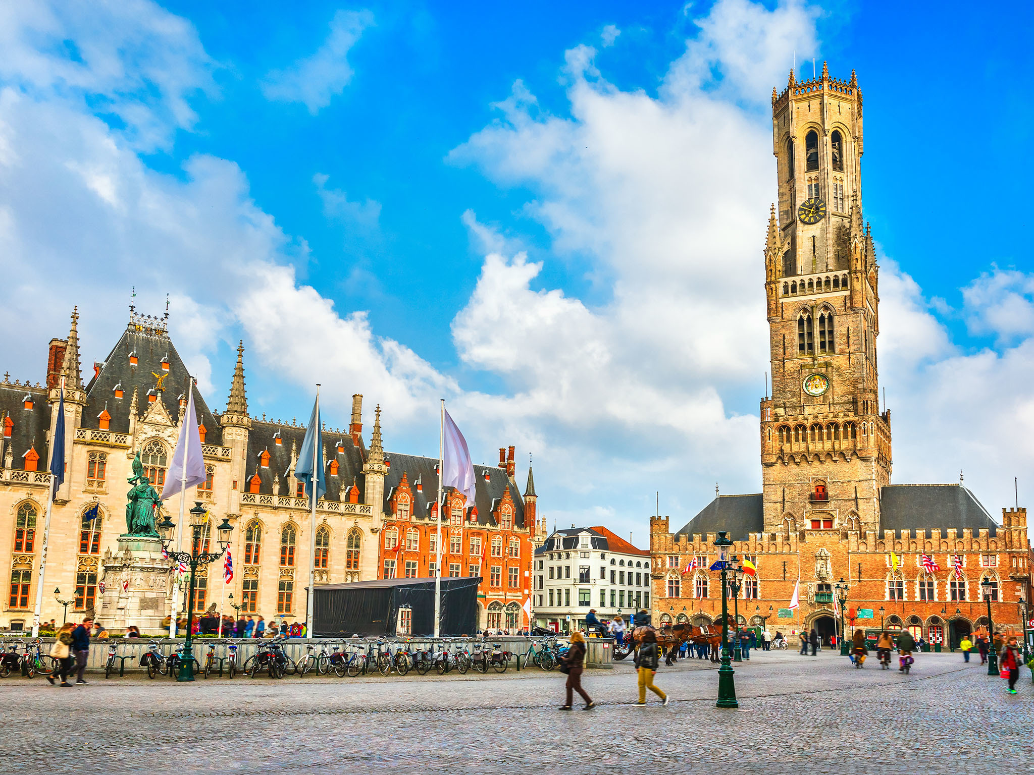
Brügge (niederländisch Brugge, französisch Bruges) ist die Hauptstadt und mit 118.284 Einwohnern (Stand 1. Januar 2018) die größte Stadt der Provinz Westflandern in Belgien. Außerdem ist Brügge Bischofssitz der katholischen Kirche für das Bistum Brügge.
Im Spätmittelalter war die niederländische Region um Brügge eines der Zentren der Textilindustrie und des Fernhandels in Europa und damit eine der Geburtsstätten des Frühkapitalismus. In der Stadt residierten zeitweise die Herzöge von Burgund, unter deren Herrschaft Brügge zu einer der wirtschaftlich und kulturell reichsten Städte im damaligen Europa wurde.
Die Altstadt ist von Wallanlagen, auf denen Windmühlen stehen, und Kanälen umgeben. Da Brügge nie durch Kriege oder großflächige Brände zerstört wurde, sind mittelalterliches Stadtbild und historische Gebäude sehr gut erhalten. Die Stadt ist sowohl zu Fuß als auch per Bootstour erkundbar. Die Kanäle, die die Stadt durchziehen, nennen die Einheimischen Reien nach dem im Mittelalter vollständig kanalisierten Flüsschen Reie, über das Brügge direkt mit der Nordsee verbunden war.
Der mittelalterliche Stadtkern wurde im Jahr 2000 von der UNESCO zum Weltkulturerbe erklärt. Im Jahr 2002 war Brügge Europäische Kulturhauptstadt.
Brügge beherbergt das renommierte Europakolleg (College of Europe) und verfügt über einen wichtigen Seehafen im Teilort Zeebrugge.
ブルッヘまたはブリュッヘ、ブルグ、ブラヘなど(フラマン語(オランダ語):Brugge[ˈbrʏʝə] 発音例)、ブリュージュ(仏語:Bruges[ˈbʁyːʒ] 発音例)、ブルージュ(英語:Bruges[ˈbruːʒ] 発音例)は、ベルギー北西部、フランデレン地域の都市で、ウェスト=フランデレン州の州都。ベルギーの代表的な観光都市の一つであり、2002年には、スペインのサラマンカとともに欧州文化首都に選定された。
日本の百科事典や地名事典では「ブルッヘ」ないし「ブリュッヘ」が用いられることが多いが、観光業などの分野では「ブルージュ」や「ブリュージュ」も多く用いられている。なお、地名の由来は「橋」であり、市内に張り巡らされた運河に架かる無数の橋に因んでいる。
Bruges (/bruːʒ/; Dutch: Brugge [ˈbrʏɣə]; French: Bruges [bʁyːʒ]; German: Brügge) is the capital and largest city of the province of West Flanders in the Flemish Region of Belgium, in the northwest of the country.
The area of the whole city amounts to more than 13,840 hectares (138.4 sq km; 53.44 sq miles), including 1,075 hectares off the coast, at Zeebrugge (from Brugge aan zee,[2] meaning "Bruges by the Sea").[3] The historic city centre is a prominent World Heritage Site of UNESCO. It is oval in shape and about 430 hectares in size. The city's total population is 117,073 (1 January 2008),[4] of whom around 20,000 live in the city centre. The metropolitan area, including the outer commuter zone, covers an area of 616 km2 (238 sq mi) and has a total of 255,844 inhabitants as of 1 January 2008.[5]
Along with a few other canal-based northern cities, such as Amsterdam, it is sometimes referred to as the Venice of the North. Bruges has a significant economic importance, thanks to its port, and was once one of the world's chief commercial cities.[6][7] Bruges is well known as the seat of the College of Europe, a university institute for European studies.[8]
Bruges (prononcé /bʁyʒ/; en néerlandais Brugge, [ˈbrʏɣə]) est une ville de Belgique située en Région flamande, chef-lieu et plus grande ville de la province de Flandre-Occidentale.
Bruges apparaît au Xe siècle en tant que place forte du comté de Flandre. En 1134, un raz-de-marée a pour conséquence bénéfique d'ouvrir un bras de mer, le Zwin, donnant un accès direct à la mer pour la ville, ce qui entraîne un développement urbain spectaculaire entre le XIIe et le XVe siècle, avec le creusement de nombreux canaux. Forte de son indépendance communale symbolisée par son beffroi, Bruges devient une plaque tournante portuaire, commerciale et financière centrale dans l'Europe du Moyen Âge, reliant les pays de la mer du Nord et de la Baltique à la Méditerranée. Les riches marchands brugeois traitaient avec ceux de toute l'Europe. La première bourse de valeurs de l'histoire est née à Bruges au XIIIe siècle. Au XVe siècle elle est la première place financière d'Europe. Cet essor économique entraîne également une floraison culturelle et artistique. Elle a été le centre le plus important pour les peintres primitifs flamands, qui ont révolutionné la peinture occidentale, et dont les œuvres sont aujourd'hui dispersées dans les grands musées du monde entier. Mais le Zwin s'ensabla peu à peu aux XVe et XVIe siècles, éloignant progressivement la ville de son accès à la mer, ce qui provoqua un déclin économique irrémédiable au profit de sa voisine, Anvers. Bruges est alors tombée au rang de simple ville provinciale.
Ce n'est qu'au XXe siècle que la ville connaît un nouveau développement grâce à la création du vaste port de Bruges-Zeebruges, qui fait aujourd'hui partie intégrante du Range nord-européen. La longue période de torpeur qu'a connu la ville après la Renaissance a permis à l'essentiel de son tissu urbain médiéval et à une bonne partie de ses monuments anciens de rester préservés. La « belle endormie » est alors apparue aux XIXe et XXe siècles comme l'un des joyaux du patrimoine européen. Ce patrimoine ancien a été méticuleusement restauré et mis en valeur. Une architecture néogothique de qualité s'est aussi développée parallèlement, faisant véritablement renaître le style local et redonnant au centre historique un aspect médiéval plus complet. Comme d'autres villes, elle est parfois surnommée la « Venise du Nord » du fait de ses canaux qui encerclent ou traversent la vieille ville dans un cadre pittoresque. Bruges est ainsi devenue la ville la plus touristique de Belgique. Elle héberge aussi le Collège d'Europe.
Elle est membre de l'Organisation des villes du patrimoine mondial depuis l'an 2000. La ville a même la particularité de figurer trois fois sur la liste du Patrimoine mondial de l'UNESCO. Pour son centre historique, pour son béguinage faisant partie des béguinages flamands et pour son beffroi comptant parmi les beffrois de Belgique et de France. En outre, elle est aussi reprise comme Patrimoine culturel immatériel de l'humanité de l'UNESCO pour sa procession du Saint-Sang. Elle fut également la capitale européenne de la culture en 2002, en même temps que la ville espagnole de Salamanque.
Bruges[1][2] (in francese, pron. /bʀyʒ/) o Brugge (in nederlandese, pron. /'brʏɣə/; nella variante fiamminga pronunciato /'brʏʝə/; Brügge in tedesco), in italiano in passato Bruggia[3], è una città del Belgio, capoluogo e maggiore città delle Fiandre Occidentali, nella Comunità fiamminga.
Sede permanente del Collegio d'Europa e di una diocesi cattolica, il centro storico medievale è stato proclamato nel 2000 patrimonio dell'umanità dall'UNESCO. Nel 2002 la città è stata capitale europea della cultura insieme alla città spagnola di Salamanca.
Brujas (en neerlandés Brugge [ˈbrʏɣə]; en francés, Bruges [bʁyːʒ]; en alemán Brügge ['bʁygə]) es una ciudad belga. Es la capital de la provincia de Flandes Occidental. Situada en el extremo noroeste de Bélgica a 90 kilómetros de la capital Bruselas, cuenta en su núcleo urbano con una población de 117.000 habitantes.
Su nombre proviene del germánico occidental "Bryggia" ("puentes", "muelles", "atracaderos"). Es interesante destacar que, en el neerlandés, «brug» significa «puente», y que esta ciudad ostenta como nombre el plural de esta palabra, debido a la gran cantidad de puentes que en ella existen.
El mayor atractivo de Brujas es su casco histórico, declarado Patrimonio de la Humanidad por la Unesco en el 2000.1 Aunque en gran parte ha sido reconstruido, dicho centro urbano es uno de los más grandes atractivos europeos, ya que mantiene intactas las estructuras arquitectónicas medievales. Al igual que Ámsterdam, Gotemburgo y Hamburgo, entre otras, Brujas es conocida como «la Venecia del norte», debido a la gran cantidad de canales que atraviesan la ciudad y a la belleza de los mismos.
Брю́гге (нидерл. Brugge [ˈbrʏʝə], фр. Bruges, нем. Brügge) — город в Бельгии, центр провинции Западная Фландрия. Один из самых живописных городов Европы [источник не указан 1036 дней]. Население — 117 172 человек (2013). Экономический и культурный расцвет Брюгге связывают с эпохой высокого и позднего Средневековья (XII—XV вв.).
 Belgium
 Eurovision Song Contest,ESC
 UEFA European Championship 2020

 History

 International cities
 *European Capital of Culture

 World Heritage
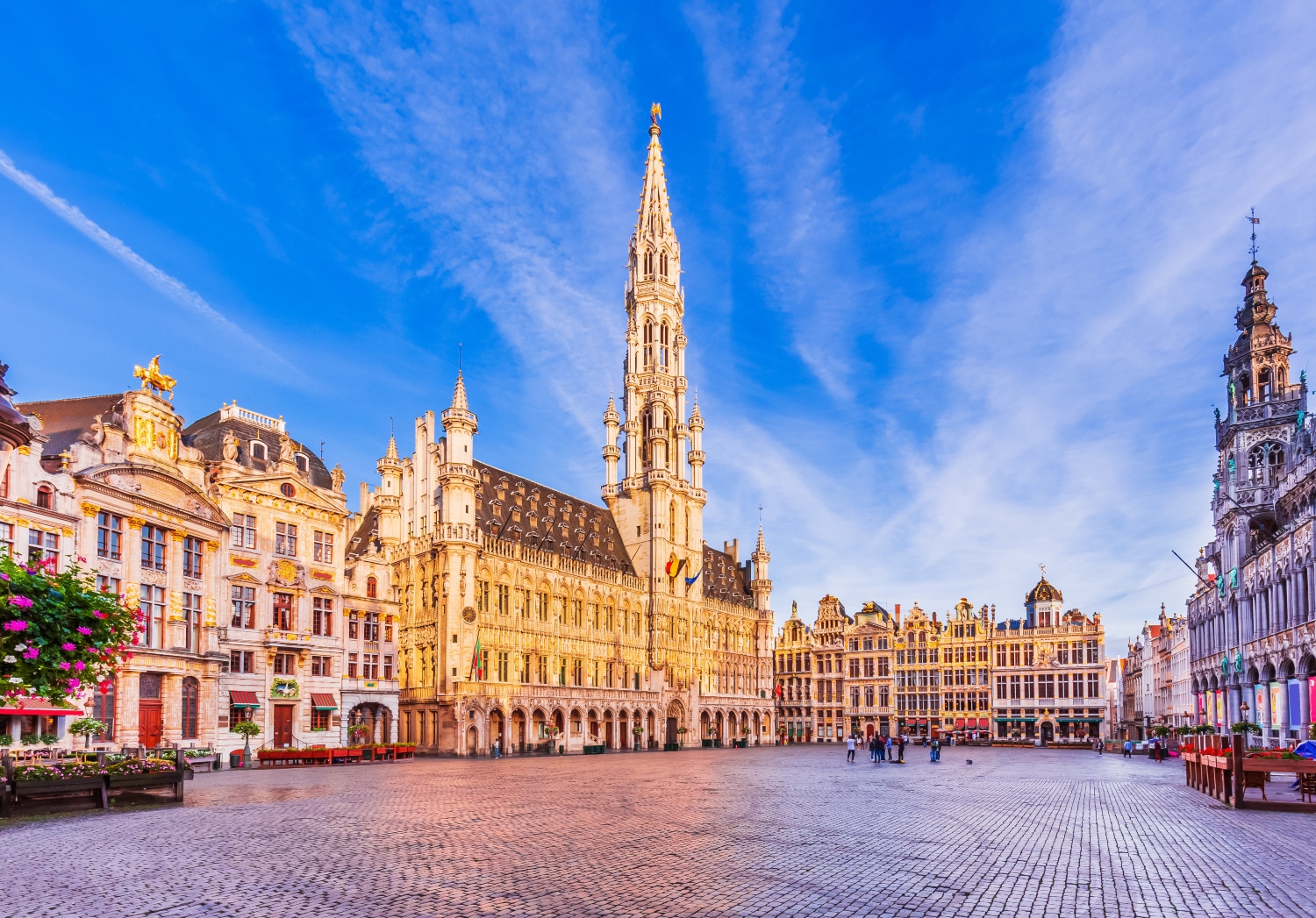

布鲁塞尔(法语:Bruxelles;荷兰语:Brussel)是比利时的首都和最大的城市,也是欧洲联盟的主要行政机构所在地。位于布鲁塞尔首都区的布鲁塞尔市,[1]。 在不同的语境中,布鲁塞尔有着不同的外延。她可能代表布鲁塞尔市(比利时的布鲁塞尔首都区中最大的地方自治体及首府,常住人口140,000),也可能代表布鲁塞尔首都区(据2008年2月1日统计,常住人口为1,067,162),或者也可能用于表示布鲁塞尔城市圈(常住人口1,350,000[2])。
欧洲联盟三个主要的机构当中,欧盟委员会和欧盟部长理事会位于布鲁塞尔,另一个重要机构欧洲议会在布鲁塞尔也有分处(全体议会在法国斯特拉斯堡),所以它有欧洲首都的美誉。另外,北大西洋公约组织的总部也设在布鲁塞尔。
布鲁塞尔是一个双语城市,通用法语和荷兰语,法语的使用者占较多数。另外,土耳其语、阿拉伯语等语言被布鲁塞尔的穆斯林广泛使用。
Mit Brüssel (französisch Bruxelles [bryˈsɛl], niederländisch Brussel [brɵsəɫ]) kann entweder eine Stadt in Belgien gemeint sein oder die größere Hauptstadtregion mit 19 Gemeinden beziehungsweise das gesamte städtische Gebiet der Hauptstadtregion.
Die zweisprachige Region Brüssel-Hauptstadt (französisch Région de Bruxelles-Capitale, niederländisch Brussels Hoofdstedelijk Gewest) ist neben Flandern und der Wallonischen Region eine von drei Regionen im föderalen belgischen Staatsaufbau. Die Region hat über eine Million Einwohner und besitzt eine höhere Bevölkerungsdichte als irgendeine deutsche Großstadt.[1] Sie ist daher nicht mit den weit ins Umland reichenden Metropolregionen vergleichbar, die in den letzten Jahren rund um viele europäische, unter anderem auch deutsche Großstädte definiert wurden. Der Ballungsraum Brüssel ist noch einmal wesentlich größer als die Region Brüssel.
Die Stadt Brüssel ist die Haupt- und Residenzstadt des Königreichs Belgien. Sie bildet das Zentrum der Region Brüssel-Hauptstadt, ist eine ihrer 19 Gemeinden und hat etwa 180.000 Einwohner. Dort haben mehrere föderale Institutionen ihren Sitz: Die Stadt Brüssel ist Verwaltungssitz der Region Brüssel-Hauptstadt. Hier befindet sich darüber hinaus der Verwaltungssitz der Französischen Gemeinschaft Belgiens, während die Wallonische Region ihren Sitz in Namur hat. Die Organe der Region Flandern und der Flämischen (niederländischsprachigen) Gemeinschaft sind fusioniert und haben ihren Sitz ebenfalls in der Stadt Brüssel. Zudem stellt die Stadt den Hauptsitz der Europäischen Union sowie den Sitz der NATO, ferner den des ständigen Sekretariats der Benelux-Länder und von EUROCONTROL dar.
Im Jahre 996 erstmals urkundlich erwähnt und im Mittelalter zur Hauptstadt des Herzogtums Brabant aufgestiegen, wurde Brüssel mit der Unabhängigkeit Belgiens 1830 zu dessen Hauptstadt erhoben. Zusammen mit seinen umliegenden Gemeinden ist Brüssel heute als Industrie- und Handelsstadt mit zwei Universitäten, mehreren Hochschulen, Akademien, Bibliotheken, Museen und Bühnen ein bedeutendes Wirtschafts-, Wissenschafts- und Kulturzentrum sowie ein wichtiger Verkehrsknotenpunkt im Zentrum des Landes.
Der Artikel Region Brüssel-Hauptstadt behandelt vor allem die Themen Politik, Verwaltung und Sprachensituation. Weitere und übergreifende Themen werden nachfolgend behandelt.
ブリュッセル市(ブリュッセルし、フランス語: Ville de Bruxelles [ˈvil də bʀyˈsɛl] または Bruxelles-Ville、オランダ語: Stad Brussel [s̪t̪ɑt̪ ˈbrʏ.s̪əl̪] または Brussel-Stad)は、ブリュッセル首都圏地域を構成する最大の基礎自治体である。ベルギーの憲法上の首都である[2]が、実際にはブリュッセル首都圏地域全体で首都としての機能を果たしている。主としてブリュッセルの歴史的中心部から成り、ロンドンにおけるシティにたとえることができる。
ブリュッセル市は、ブリュッセルの歴史的な中心市街地に加えて、ブリュッセル首都圏地域内のいくつかの地区、すなわち北部のアレン、ラーケンおよびネデル=オヴェル=エンベーク、ならびに南部のルイーズ大通りおよびカンブルの森から構成される。
ブリュッセル市の総面積は32.61 km2、2014年9月1日現在の総人口は173,540人で、人口密度は5,321.68人/km2である[1]。また2014年時点で、ブリュッセル市の人口約17万人のうち、約6万人が外国人(うち3万6千人がEU市民、2万4千人が非EU市民)となっている[3]。
The City of Brussels (French: Ville de Bruxelles [vil də bʁysɛl] or alternatively Bruxelles-Ville [bʁysɛl vil], Dutch: Stad Brussel [stɑd ˈbrɵsəl][2] or Brussel-Stad) is the largest municipality and historical centre of the Brussels-Capital Region, and the de jure capital of Belgium.[3] Besides the strict centre, it also covers the immediate northern outskirts where it borders municipalities in Flanders. It is the administrative centre of the European Union, thus often dubbed, along with the region, the EU's capital city.
The City of Brussels is a municipality consisting of the central historic town and certain additional areas within the greater Brussels-Capital Region, namely Haren, Laeken and Neder-Over-Heembeek to the north, and Avenue Louise/Louizalaan and the Bois de la Cambre/Ter Kamerenbos park to the south.
On 1 January 2017, the City of Brussels had a total population of 176,545. The total area is 32.61 km2 (12.59 sq mi) which gives a population density of 5,475 inhabitants per square kilometre (14,180/sq mi). As of 2007, there were approximately 50,000 registered non-Belgians in the City of Brussels.[4] In common with all the Brussels municipalities, it is legally bilingual (French–Dutch).
Bruxelles (prononcé [bʁy.sɛl]1 Écouter ; Brussel [ˈbrʏ.səl] Écouter en néerlandais ; Brüssel en allemand ; parfois aussi appelé aire urbaine de Bruxelles, Stedelijk gebied van Brussel en néerlandais, ou Grand Bruxelles2) est une agglomération de Belgique qui s'étend au-delà des limites administratives de la Région de Bruxelles-Capitale pour englober des parties du Brabant wallon et l'arrondissement de Hal-Vilvorde, et au centre de laquelle se trouve la ville de Bruxelles proprement dite.
La plupart des institutions de l’Union européenne, ainsi que de nombreuses organisations internationales entre autres lobbyistes, dont l’OTAN, ont leur siège en Région de Bruxelles-Capitale. Par extension, on dit donc « Bruxelles » pour désigner, en général et par métonymie, les institutions européennes (le plus souvent, la Commission européenne).
L'initiative Brussels Metropolitan, lancée en 2008, vise à mieux coordonner la ville et son arrière-pays pour valoriser le Grand Bruxelles en tant que métropole économique attrayante au cœur de l'Europe3, lui donner plus de poids sur le plan mondial et y stimuler la croissance et la création d'emplois4. Cette plateforme de coopération implique la participation de quatre organisations patronales - la FEB, BECI, le Voka et l'UWE4.
Bruxelles (nome francese; pronuncia /bʀy'sɛl/ o, meno correttamente, /bʀyk'sɛl/, italianizzata in /brukˈsɛl/[1]; in olandese Brussel, in tedesco Brüssel; in italiano storico Brusselle[2] o Borsella[3]) è un'area metropolitana del Belgio che ospita all'incirca 2,6 milioni di abitanti.[4]
Il comune di Bruxelles è uno dei 19 comuni della regione amministrativa di "Bruxelles-capitale", con cui non dovrebbe essere confuso. Questa regione è una delle tre regioni amministrative del Belgio, con la Regione vallone e la Regione fiamminga. L'area metropolitana di Bruxelles si estende oltre i confini amministrativi della Regione di Bruxelles in quanto comprende molti comuni situati nella regione fiamminga. Questa situazione è all'origine del conflitto linguistico in Belgio poiché molti residenti di Bruxelles, per lo più francofoni, sono stabiliti nella regione fiamminga di lingua olandese.
Bruxelles è considerata la capitale de facto dell'Unione europea in quanto sede di varie istituzioni, tra cui la Commissione europea, il Consiglio dell'Unione europea e parzialmente il Parlamento europeo (ufficialmente con sede a Strasburgo). Ad Evere ha inoltre sede il quartier generale della NATO. Bruxelles ospita anche il Comitato delle Regioni e il Comitato economico e sociale.
Gran parte dell'area metropolitana di Bruxelles è amministrata dalla regione di Bruxelles-Capitale, suddivisa in 19 comuni, tra cui quello del centro storico, il Comune di Bruxelles (Ville de Bruxelles/Brussel-stad). La città si estende però anche al di là dei confini della regione: vari comuni della periferia brussellese, amministrativamente parte della regione delle Fiandre, sono parte integrante del tessuto urbano di Bruxelles.[5] Tra questi Zaventem (sede dell'aeroporto internazionale), Kraainem (capolinea della metropolitana) e Tervuren (quartiere residenziale).
Bruselas (en francés: Bruxelles ![]() [bʁysɛl] (?·i), en neerlandés: Brussel
[bʁysɛl] (?·i), en neerlandés: Brussel ![]() [ˈbrɵsəl] (?·i) y en alemán: Brüssel) es la capital de Bélgica,1 y la principal sede administrativa de la Unión Europea (UE).
[ˈbrɵsəl] (?·i) y en alemán: Brüssel) es la capital de Bélgica,1 y la principal sede administrativa de la Unión Europea (UE).
Bruselas es un municipio situado en la región administrativa "Bruselas-Capital" que es una de las tres regiones de Bélgica, con la Región Valona y la Región flamenca.
Como capital del Estado, Bruselas es la sede del gobierno y el Parlamento. Alberga también, el Castillo de Laeken la residencia de Su Majestad el rey Felipe de Bélgica y la familia real belga.
Брюссе́льский столи́чный регио́н (фр. Région de Bruxelles-Capitale, ʁe'ʒjɔ̃ də bʁy'sɛlkapi'tal ![]() слушать, нидерл. Brussels Hoofdstedelijk Gewest, ˈbrʏsəɫs ɦoːft'steːdələk xəʋɛst
слушать, нидерл. Brussels Hoofdstedelijk Gewest, ˈbrʏsəɫs ɦoːft'steːdələk xəʋɛst ![]() слушать, а также просто фр. Bruxelles, bʁysɛl
слушать, а также просто фр. Bruxelles, bʁysɛl ![]() слушать; нидерл. Brussel, ˈbrʏsəɫ
слушать; нидерл. Brussel, ˈbrʏsəɫ ![]() слушать) — один из трёх регионов Бельгии, субъект федерации наравне с Фламандским и Валлонским регионами. Крупнейшая городская зона-агломерация в Бельгии[1], состоящая из 19 муниципалитетов, каждый со своим бургомистром, ратушей и т. д. Фактически они являются районами одного города (часто граница проходит посередине улицы). Формально название Брюссель относится только к одному из вышеуказанных муниципалитетов, но на практике его употребляют ко всей агломерации. Одним из муниципалитетов является Брюссель, который де-юре является столицей Бельгии, и в котором находятся Французское и Фламандское сообщества[2]. Де-факто, в силу того что столичные учреждения распределены по различным муниципалитететам Брюссельского столичного региона, регион считается столицей Бельгии, столицей Европейского союза[3].
слушать) — один из трёх регионов Бельгии, субъект федерации наравне с Фламандским и Валлонским регионами. Крупнейшая городская зона-агломерация в Бельгии[1], состоящая из 19 муниципалитетов, каждый со своим бургомистром, ратушей и т. д. Фактически они являются районами одного города (часто граница проходит посередине улицы). Формально название Брюссель относится только к одному из вышеуказанных муниципалитетов, но на практике его употребляют ко всей агломерации. Одним из муниципалитетов является Брюссель, который де-юре является столицей Бельгии, и в котором находятся Французское и Фламандское сообщества[2]. Де-факто, в силу того что столичные учреждения распределены по различным муниципалитететам Брюссельского столичного региона, регион считается столицей Бельгии, столицей Европейского союза[3].
Брюссель начинался как город-крепость в 10 веке, основанный Карлом I[4]. Население региона составляет 1,1 миллион человек, а всё население метрополии — более 1,8 миллионов, занимая таким образом первое место по этому показателю в Бельгии[5][6]. Со времён окончания Второй мировой войны Брюссель является одним из главных центров мировой политики. Будучи местом расположения институтов Европейского союза[7] и штаб-квартиры НАТО, Брюссель стал многоязыковым домом для многочисленных международных организаций, политиков и дипломатов[8].
Исторически нидерландоязычный, Брюссель со времён обретения Бельгией независимости в 1830 году, превратился почти полностью во франкоязычный регион. На сегодняшний день официальными считаются оба языка. Все дорожные знаки, названия улиц и большая часть рекламы и названий услуг приводятся на двух языках[9]. Языковой вопрос остаётся острым в Брюсселе, законы, затрагивающие его, являются предметом неутихающих обсуждений в Бельгии.
 Germany

 International cities

 International cities
 *European Capital of Culture

 Saxony

 Vacation and Travel


“开姆尼茨”是德国少数民族索布族语“石头”的意思。开姆尼茨曾经是德国现代工业文明的发源地之一,德国历史上的第一部自行车、第一台缝纫机都产于这里。 然而,在整个20世纪,开姆尼茨和德国其他城市特别是东部城市一样,经历了两次世界大战的创伤和长期计划经济的束缚,传统的制造业优势不复存在。今后的路 怎么走,国家在城市发展中有什么举措,不仅是当地人民思考的问题,更为世人所关注。在从计划经济向市场经济过渡的过程中,开姆尼茨会带给人们什么样的启 示?
工业重镇呼唤新生
早在1779年,开姆尼茨就开始了工业化进程,当矿山资源 被采绝之后,矿工和业主都急于寻找新的收入来源,于是他们转向了工业技术。聪明的工程师们很快就制造出了强于竞争对手英国人的机器。他们的功绩之一,是建 起了第一个全机械化的纺织厂,使开姆尼茨成为当时德国最重要的纺织工业基地之一,并享有“萨克森灯芯绒”之称,被誉为德国的曼彻斯特。1862年在巴黎国 际展览会上,德国的产品第一次获得了金奖。这个获奖的金属加工机床,就是开姆尼茨市齐墨曼公司制造的。
德国的现代汽车工业的发展更是和开姆尼茨息息相关。可能没有人知道在中国大街小巷随处可见的奥迪牌轿车那四个相连的银白色圆环的标志最初就是诞生在这里。
作为萨克森州第三大城市的开姆尼茨的知名度远比不上同州的德累斯顿和莱比锡。为此,德国统一后实施的振兴东部计划,将开姆尼茨等东部著名城市的复兴摆在 了重要的位置。近年来,开姆尼茨市的经济在蓬勃发展,很多世界著名的大公司,如西门子、IBM和大众汽车等也在这里安家落户,并且正在充分利用这里的技术 资源。今天的开姆尼茨正成为一个德国东部经济发展的亮点。其重点为机械制造、汽车及其配件工业和高科技产业。
开姆尼茨[2](德语:Chemnitz,发音:[ˈkɛmnɪts] (ⓘ);索布语:Kamjenica;捷克语:Saská Kamenice;波兰语:Kamienica Saska)市是德国萨克森州西部的一座非县辖城市,总面积为220.85平方千米,截至2023年12月31日总人口为250,681人。开姆尼茨是位于莱比锡和德累斯顿之后的该州第三大城市,也是该州六个Oberzentren之一。开姆尼茨的城市格言是“有头脑的城市”(Stadt mit Köpfchen)。
该市同茨维考一起构成了“开姆尼茨-茨维考经济区”的核心,也是“萨克森三角城市群”的组成部分。
“开姆尼茨”得名于流经该市的一条同名河流。在东德治下的1953年5月10日到1990年6月1日期间,开姆尼茨改称“卡尔·马克思城”(Karl-Marx-Stadt)。
1143年有文献记载中提到,该市已发展为德国工业化城市中重要的一个。开姆尼茨市的人口数大约自1883年起便超过了十万。
Chemnitz [ˈkʰɛmnɪt͡s] ![]()
![]() (von 1953 bis 1990 Karl-Marx-Stadt) ist eine kreisfreie Stadt im Südwesten des Freistaates Sachsen und dessen drittgrößte Großstadt nach Leipzig und Dresden. Wegen Rauch- und Schmutzentwicklung während der Industrialisierung erhielt Chemnitz den Beinamen Sächsisches Manchester.
(von 1953 bis 1990 Karl-Marx-Stadt) ist eine kreisfreie Stadt im Südwesten des Freistaates Sachsen und dessen drittgrößte Großstadt nach Leipzig und Dresden. Wegen Rauch- und Schmutzentwicklung während der Industrialisierung erhielt Chemnitz den Beinamen Sächsisches Manchester.
Der namensgebende Fluss verläuft durch die am Nordrand des Erzgebirges im Erzgebirgsbecken liegende Stadt. Chemnitz ist Hauptsitz der Landesdirektion Sachsen und Teil der Metropolregion Mitteldeutschland. Am 28. Oktober 2020 wurde die Stadt als Kulturhauptstadt Europas 2025 ausgewählt.
Die älteste urkundliche Erwähnung als Kameniz (von sorbisch kamjenica, „Steinbach“) datiert aus dem Jahre 1143. Mit der industriellen Revolution setzte im 19. Jahrhundert ein starkes Bevölkerungswachstum ein; nach der Reichsgründung 1871 entwickelte sich Chemnitz zu einer wichtigen Industriestadt. In der Zeit der Hochindustrialisierung im Deutschen Reich wurde Chemnitz im Laufe des Jahres 1882 zur Großstadt. Die Einwohnerzahl erreichte zu Beginn der 1930er-Jahre mit über 361.000 Personen ihren historischen Höchstwert. Im Zweiten Weltkrieg wurde bei den Luftangriffen auf Chemnitz im Februar und März 1945 die Innenstadt zu 80 % zerstört.[2] Auf Beschluss des ZK der SED und der Regierung der DDR erfolgte am 10. Mai 1953 die Umbenennung in Karl-Marx-Stadt.[3]
Mit ihrer über 200-jährigen Industriegeschichte ist die Stadt ein Technologiestandort mit den Branchenschwerpunkten Automobil- und Zulieferindustrie, Informationstechnologie sowie Maschinen- und Anlagenbau. Über 50 % der Stadt bestehen aus Gebäuden von vor 1950 und es gibt zahlreiche Denkmäler der Industriekultur.[4] Chemnitz ist Standort einer Technischen Universität.
In der Stadt im Erzgebirgsvorland befinden sich zahlreiche Freizeiteinrichtungen und Museen, darunter die Kunstsammlungen Chemnitz und das Staatliche Museum für Archäologie Chemnitz.
Bekannte Söhne und Töchter der Stadt sind der Maler Karl Schmidt-Rottluff, der Schriftsteller Stefan Heym, die Designerin Marianne Brandt sowie die Eiskunstlauf-Olympiasiegerin Katarina Witt und der Bergsteiger Jörg Stingl, der als zweiter Deutscher den Mount Everest ohne zusätzlichen Sauerstoff bestieg.
 Medieval cities in Europe